This weather event on September 16, 2024 includes:
3 states
29 counties,
10 cities,
and 69 zip codes.
There were 658 total properties that were impacted and have possible damage.
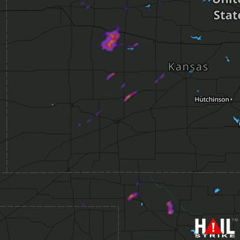 DODGE CITY (KDDC) RADAR
States Impacted By Hail On September 16, 2024
Kansas
·
Oklahoma
·
Texas
Counties Impacted By Hail On September 16, 2024
Decatur, KS
·
Ellis, KS
·
Ellsworth, KS
·
Finney, KS
·
Ford, KS
·
Gove, KS
·
Graham, KS
·
Gray, KS
·
Haskell, KS
·
Hodgeman, KS
·
Kearny, KS
·
Lane, KS
·
Ness, KS
·
Norton, KS
·
Osborne, KS
·
Pawnee, KS
·
Phillips, KS
·
Rooks, KS
·
Rush, KS
·
Russell, KS
·
Scott, KS
·
Sheridan, KS
·
Trego, KS
·
Beaver, OK
·
Ellis, OK
·
Harper, OK
·
Woodward, OK
·
Lipscomb, TX
·
Ochiltree, TX
Cities Impacted By Hail On September 16, 2024
Buffalo, OK
·
Collyer, KS
·
Garden City, KS
·
Hill City, KS
·
Ingalls, KS
·
Jetmore, KS
·
Oberlin, KS
·
Quinter, KS
·
Russell, KS
·
Selden, KS
Zip Codes Impacted By Hail On September 16, 2024
66951
·
67439
·
67459
·
67473
·
67513
·
67516
·
67518
·
67520
·
67521
·
67523
·
67548
·
67556
·
67560
·
67572
·
67574
·
67575
·
67584
·
67601
·
67621
·
67631
·
67632
·
67635
·
67637
·
67639
·
67642
·
67644
·
67645
·
67650
·
67656
·
67658
·
67659
·
67661
·
67663
·
67664
·
67665
·
67669
·
67672
·
67736
·
67737
·
67738
·
67740
·
67749
·
67751
·
67752
·
67753
·
67757
·
67801
·
67835
·
67837
·
67839
·
67846
·
67849
·
67850
·
67851
·
67853
·
67860
·
67868
·
67871
·
67877
·
73834
·
73848
·
73851
·
73931
·
73932
·
79005
·
79070
·
73852
·
67854
·
67625

