This weather event on September 5, 2024 includes:
2 states
18 counties,
22 cities,
and 62 zip codes.
There were 955 total properties that were impacted and have possible damage.
States Impacted By Hail On September 5, 2024
Iowa
·
Minnesota
Counties Impacted By Hail On September 5, 2024
Bremer, IA
·
Buena Vista, IA
·
Carroll, IA
·
Cerro Gordo, IA
·
Chickasaw, IA
·
Floyd, IA
·
Hancock, IA
·
Howard, IA
·
Ida, IA
·
Kossuth, IA
·
Mitchell, IA
·
Pocahontas, IA
·
Sac, IA
·
Winnebago, IA
·
Winneshiek, IA
·
Worth, IA
·
Freeborn, MN
·
Mower, MN
Cities Impacted By Hail On September 5, 2024
Algona, IA
·
Alta, IA
·
Bassett, IA
·
Bolan, IA
·
Carpenter, IA
·
Charles City, IA
·
Corwith, IA
·
Crystal Lake, IA
·
Fertile, IA
·
Floyd, IA
·
Hanlontown, IA
·
Hayward, MN
·
Ionia, IA
·
Irvington, IA
·
Mason City, IA
·
Nora Springs, IA
·
Northwood, IA
·
Ossian, IA
·
Plymouth, IA
·
Rock Falls, IA
·
Rose Creek, MN
·
Roseville, IA
Zip Codes Impacted By Hail On September 5, 2024
50401
·
50423
·
50428
·
50430
·
50434
·
50435
·
50436
·
50440
·
50444
·
50446
·
50447
·
50448
·
50450
·
50456
·
50458
·
50461
·
50464
·
50468
·
50471
·
50472
·
50473
·
50511
·
50519
·
50546
·
50558
·
50560
·
50571
·
50574
·
50575
·
50581
·
50597
·
50616
·
50628
·
50645
·
50658
·
50659
·
50674
·
51002
·
51006
·
51018
·
51025
·
51430
·
51445
·
51450
·
52101
·
52132
·
52136
·
52154
·
52161
·
52163
·
52165
·
55912
·
55953
·
55970
·
56007
·
56009
·
56029
·
56036
·
56043
·
55909
·
50459
·
50432
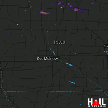 DES MOINES (KDMX) RADAR

