This weather event on August 31, 2024 includes:
3 states
15 counties,
24 cities,
and 68 zip codes.
There were total properties that were impacted and have possible damage.
States Impacted By Hail On August 31, 2024
Maryland
·
North Carolina
·
Virginia
Counties Impacted By Hail On August 31, 2024
Montgomery, MD
·
Beaufort, NC
·
Hyde, NC
·
Albemarle, VA
·
Amherst, VA
·
Augusta, VA
·
Bedford, VA
·
Buckingham, VA
·
Campbell, VA
·
Charlottesville, VA
·
Fauquier, VA
·
Nelson, VA
·
Rockbridge, VA
·
Rockingham, VA
·
Waynesboro, VA
Cities Impacted By Hail On August 31, 2024
Arrington, VA
·
Bethesda, MD
·
Cabin John, MD
·
Charlottesville, VA
·
Fishersville, VA
·
Glen Echo, MD
·
Greenville, VA
·
Grottoes, VA
·
Lovingston, VA
·
Lyndhurst, VA
·
Marshall, VA
·
Middlebrook, VA
·
Nellysford, VA
·
New Hope, VA
·
Pantops, VA
·
Potomac, MD
·
Sherando, VA
·
Shipman, VA
·
Stuarts Draft, VA
·
Timberlake, VA
·
University of Virginia, VA
·
Waynesboro, VA
·
Wintergreen, VA
·
Yogaville, VA
Zip Codes Impacted By Hail On August 31, 2024
20115
·
20144
·
20198
·
20814
·
20815
·
20816
·
20817
·
20818
·
20854
·
22901
·
22902
·
22903
·
22911
·
22920
·
22922
·
22932
·
22936
·
22937
·
22938
·
22939
·
22940
·
22947
·
22949
·
22952
·
22958
·
22959
·
22964
·
22967
·
22971
·
22974
·
22976
·
22980
·
23921
·
24401
·
24415
·
24416
·
24435
·
24437
·
24440
·
24441
·
24450
·
24459
·
24464
·
24471
·
24472
·
24473
·
24476
·
24477
·
24482
·
24483
·
24501
·
24521
·
24523
·
24550
·
24553
·
24562
·
24570
·
24574
·
24581
·
24588
·
24590
·
24599
·
27810
·
27860
·
24556
·
24479
·
22904
·
20812
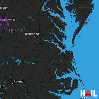 NORFOLK/RICH (KAKQ) RADAR

