This weather event on August 31, 2024 includes:
3 states
21 counties,
22 cities,
and 43 zip codes.
There were total properties that were impacted and have possible damage.
States Impacted By Hail On August 31, 2024
Indiana
·
Kentucky
·
Ohio
Counties Impacted By Hail On August 31, 2024
Crawford, IN
·
Harrison, IN
·
Spencer, IN
·
Bourbon, KY
·
Bracken, KY
·
Breckinridge, KY
·
Bullitt, KY
·
Daviess, KY
·
Fayette, KY
·
Hancock, KY
·
Hardin, KY
·
Harrison, KY
·
Jefferson, KY
·
Mason, KY
·
Meade, KY
·
Nelson, KY
·
Ohio, KY
·
Robertson, KY
·
Scott, KY
·
Woodford, KY
·
Highland, OH
Cities Impacted By Hail On August 31, 2024
Bardstown, KY
·
Briarwood, KY
·
Crossgate, KY
·
Germantown, KY
·
Graymoor-Devondale, KY
·
Hardinsburg, KY
·
Indian Hills, KY
·
Irvington, KY
·
Langdon Place, KY
·
Lebanon Junction, KY
·
Lewisport, KY
·
Lexington-Fayette, KY
·
Lyndon, KY
·
Maryhill Estates, KY
·
Northfield, KY
·
Owensboro, KY
·
Plantation, KY
·
St. Matthews, KY
·
Westwood, KY
·
Whitesville, KY
·
Windy Hills, KY
·
Woodlawn Park, KY
Zip Codes Impacted By Hail On August 31, 2024
40004
·
40048
·
40104
·
40107
·
40111
·
40119
·
40142
·
40143
·
40144
·
40146
·
40150
·
40165
·
40176
·
40207
·
40222
·
40241
·
40242
·
40324
·
40347
·
40361
·
40383
·
40511
·
41002
·
41004
·
41031
·
41034
·
41044
·
41062
·
42301
·
42303
·
42343
·
42351
·
42366
·
42368
·
42378
·
42701
·
45133
·
45697
·
47112
·
47137
·
47615
·
41064
·
40510
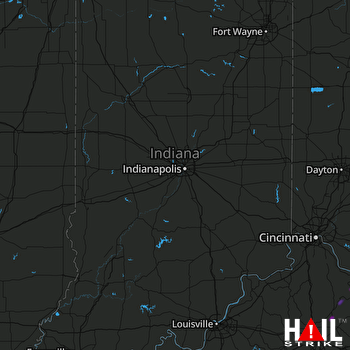 INDIANAPOLIS (KIND) RADAR

