This weather event on August 29, 2024 includes:
2 states
24 counties,
18 cities,
and 89 zip codes.
There were 21 total properties that were impacted and have possible damage.
States Impacted By Hail On August 29, 2024
North Carolina
·
Virginia
Counties Impacted By Hail On August 29, 2024
Granville, NC
·
Rockingham, NC
·
Vance, NC
·
Amelia, VA
·
Amherst, VA
·
Bedford, VA
·
Brunswick, VA
·
Buckingham, VA
·
Campbell, VA
·
Charlotte, VA
·
Chesterfield, VA
·
Cumberland, VA
·
Dinwiddie, VA
·
Franklin, VA
·
Goochland, VA
·
Halifax, VA
·
Henry, VA
·
Lunenburg, VA
·
Mecklenburg, VA
·
Nottoway, VA
·
Petersburg, VA
·
Pittsylvania, VA
·
Powhatan, VA
·
Prince Edward, VA
Cities Impacted By Hail On August 29, 2024
Altavista, VA
·
Amelia Court House, VA
·
Boydton, VA
·
Brandermill, VA
·
Chester, VA
·
Hampden-Sydney, VA
·
Horse Pasture, VA
·
Hurt, VA
·
Keysville, VA
·
Motley, VA
·
North Shore, VA
·
Petersburg, VA
·
Powhatan, VA
·
Rockwood, VA
·
South Hill, VA
·
Union Hall, VA
·
Westlake Corner, VA
·
Yogaville, VA
Zip Codes Impacted By Hail On August 29, 2024
23002
·
23038
·
23040
·
23063
·
23083
·
23102
·
23112
·
23114
·
23139
·
23236
·
23237
·
23803
·
23805
·
23821
·
23824
·
23832
·
23833
·
23841
·
23850
·
23872
·
23876
·
23882
·
23885
·
23894
·
23915
·
23917
·
23920
·
23921
·
23922
·
23923
·
23924
·
23927
·
23934
·
23936
·
23937
·
23942
·
23943
·
23944
·
23947
·
23950
·
23952
·
23954
·
23958
·
23962
·
23966
·
23967
·
23968
·
23970
·
23974
·
24065
·
24067
·
24092
·
24101
·
24104
·
24121
·
24148
·
24151
·
24165
·
24176
·
24184
·
24517
·
24521
·
24523
·
24526
·
24529
·
24550
·
24554
·
24557
·
24558
·
24562
·
24563
·
24566
·
24569
·
24571
·
24574
·
24588
·
24589
·
24590
·
24592
·
24598
·
27048
·
27537
·
27565
·
24556
·
24501
·
23901
·
23831
·
23120
·
23027
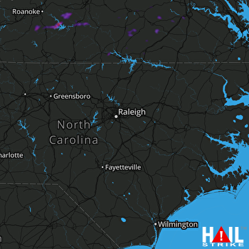 RALEIGH/DUR (KRAX) RADAR

