This weather event on August 28, 2024 includes:
1 states
24 counties,
21 cities,
and 96 zip codes.
There were 1585 total properties that were impacted and have possible damage.
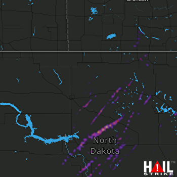 MINOT AFB (KMBX) RADAR
States Impacted By Hail On August 28, 2024
North Dakota
Counties Impacted By Hail On August 28, 2024
Benson, ND
·
Bottineau, ND
·
Burleigh, ND
·
Eddy, ND
·
Foster, ND
·
Griggs, ND
·
Kidder, ND
·
Logan, ND
·
McHenry, ND
·
McLean, ND
·
Mercer, ND
·
Morton, ND
·
Nelson, ND
·
Oliver, ND
·
Pierce, ND
·
Ramsey, ND
·
Rolette, ND
·
Sheridan, ND
·
Sioux, ND
·
Steele, ND
·
Stutsman, ND
·
Towner, ND
·
Ward, ND
·
Wells, ND
Cities Impacted By Hail On August 28, 2024
Aneta, ND
·
Bowdon, ND
·
Cleveland, ND
·
Crary, ND
·
Driscoll, ND
·
Esmond, ND
·
Glenfield, ND
·
Granville, ND
·
Hansboro, ND
·
Harmon, ND
·
Harvey, ND
·
Mandan, ND
·
Rugby, ND
·
Sawyer, ND
·
Selz, ND
·
Stanton, ND
·
Streeter, ND
·
Turtle Lake, ND
·
Underwood, ND
·
Wing, ND
·
York, ND
Zip Codes Impacted By Hail On August 28, 2024
58212
·
58254
·
58301
·
58316
·
58317
·
58324
·
58327
·
58329
·
58332
·
58339
·
58341
·
58343
·
58346
·
58348
·
58351
·
58356
·
58363
·
58365
·
58366
·
58367
·
58368
·
58370
·
58374
·
58377
·
58379
·
58380
·
58384
·
58385
·
58386
·
58401
·
58416
·
58418
·
58420
·
58421
·
58422
·
58423
·
58424
·
58430
·
58438
·
58442
·
58443
·
58444
·
58451
·
58455
·
58463
·
58464
·
58467
·
58477
·
58483
·
58484
·
58486
·
58488
·
58494
·
58496
·
58503
·
58504
·
58521
·
58530
·
58531
·
58532
·
58540
·
58545
·
58549
·
58554
·
58558
·
58559
·
58561
·
58563
·
58570
·
58571
·
58572
·
58575
·
58576
·
58577
·
58579
·
58712
·
58716
·
58723
·
58731
·
58736
·
58741
·
58744
·
58748
·
58758
·
58759
·
58768
·
58778
·
58781
·
58788
·
58789
·
58790
·
58792
·
58710
·
58566
·
58487
·
58381

