This weather event on July 25, 2024 includes:
4 states
26 counties,
17 cities,
and 82 zip codes.
There were 2654 total properties that were impacted and have possible damage.
States Impacted By Hail On July 25, 2024
Illinois
·
Indiana
·
Kentucky
·
Missouri
Counties Impacted By Hail On July 25, 2024
Alexander, IL
·
Gallatin, IL
·
Jefferson, IL
·
Johnson, IL
·
Marion, IL
·
Massac, IL
·
Pope, IL
·
Pulaski, IL
·
Saline, IL
·
Union, IL
·
Wayne, IL
·
White, IL
·
Williamson, IL
·
Posey, IN
·
Ballard, KY
·
Caldwell, KY
·
Crittenden, KY
·
Hopkins, KY
·
Livingston, KY
·
McCracken, KY
·
Union, KY
·
Webster, KY
·
Bollinger, MO
·
Cape Girardeau, MO
·
Scott, MO
·
Stoddard, MO
Cities Impacted By Hail On July 25, 2024
Bandana, KY
·
Buncombe, IL
·
Carmi, IL
·
Carrier Mills, IL
·
Dawson Springs, KY
·
Goreville, IL
·
Harrisburg, IL
·
Johnston City, IL
·
Kevil, KY
·
La Center, KY
·
Marion, IL
·
Metropolis, IL
·
Mill Shoals, IL
·
Mound City, IL
·
Mount Vernon, IL
·
Old Shawneetown, IL
·
Woodlawn, IL
Zip Codes Impacted By Hail On July 25, 2024
42022
·
42024
·
42028
·
42047
·
42053
·
42056
·
42064
·
42086
·
42404
·
42408
·
42409
·
42411
·
42431
·
42437
·
42445
·
42453
·
42459
·
47633
·
62446
·
62809
·
62814
·
62821
·
62823
·
62824
·
62837
·
62850
·
62851
·
62862
·
62864
·
62869
·
62871
·
62878
·
62883
·
62894
·
62895
·
62896
·
62898
·
62899
·
62906
·
62910
·
62912
·
62917
·
62922
·
62926
·
62928
·
62934
·
62935
·
62938
·
62939
·
62946
·
62951
·
62952
·
62954
·
62957
·
62959
·
62960
·
62964
·
62969
·
62972
·
62974
·
62984
·
62985
·
62987
·
62988
·
62990
·
62992
·
62995
·
63701
·
63735
·
63750
·
63751
·
63755
·
63760
·
63780
·
63785
·
63787
·
63825
·
42001
·
42078
·
62923
·
62943
·
62963
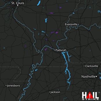 PADUCAH (KPAH) RADAR

