This weather event on July 23, 2024 includes:
6 states
32 counties,
11 cities,
and 70 zip codes.
There were 168 total properties that were impacted and have possible damage.
States Impacted By Hail On July 23, 2024
Kentucky
·
North Carolina
·
Ohio
·
Tennessee
·
Virginia
·
West Virginia
Counties Impacted By Hail On July 23, 2024
Anderson, KY
·
Bell, KY
·
Fayette, KY
·
Jessamine, KY
·
Knox, KY
·
Lewis, KY
·
Mason, KY
·
McCreary, KY
·
Nelson, KY
·
Pike, KY
·
Pulaski, KY
·
Whitley, KY
·
Woodford, KY
·
Ashe, NC
·
Watauga, NC
·
Wilkes, NC
·
Adams, OH
·
Highland, OH
·
Hocking, OH
·
Pickaway, OH
·
Ross, OH
·
Scioto, OH
·
Vinton, OH
·
Scott, TN
·
Grayson, VA
·
Tazewell, VA
·
Lincoln, WV
·
McDowell, WV
·
Monroe, WV
·
Putnam, WV
·
Roane, WV
·
Summers, WV
Cities Impacted By Hail On July 23, 2024
Adelphi, OH
·
Flat Lick, KY
·
Gary, WV
·
Hillsboro, OH
·
Kingston, OH
·
Laurelville, OH
·
Lexington-Fayette, KY
·
Rome, OH
·
Rosemount, OH
·
Versailles, KY
·
West Portsmouth, OH
Zip Codes Impacted By Hail On July 23, 2024
24326
·
24348
·
24605
·
24606
·
24635
·
24808
·
24830
·
24836
·
24848
·
24871
·
24884
·
24888
·
24918
·
24963
·
25033
·
25123
·
25124
·
25159
·
25168
·
25243
·
25286
·
25521
·
25526
·
25564
·
25951
·
28618
·
28626
·
28649
·
28651
·
28665
·
37841
·
40004
·
40107
·
40342
·
40356
·
40383
·
40513
·
40769
·
40902
·
40906
·
40935
·
40939
·
40977
·
41056
·
41179
·
41189
·
41501
·
41560
·
42501
·
42647
·
42649
·
43101
·
43113
·
43135
·
43149
·
43152
·
43164
·
45123
·
45133
·
45601
·
45616
·
45628
·
45644
·
45647
·
45651
·
45657
·
45662
·
45663
·
45681
·
45684
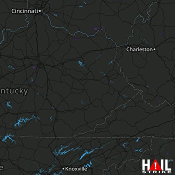 JACKSON (KJKL) RADAR

