This weather event on July 23, 2024 includes:
2 states
18 counties,
23 cities,
and 65 zip codes.
There were 186 total properties that were impacted and have possible damage.
States Impacted By Hail On July 23, 2024
Iowa
·
Minnesota
Counties Impacted By Hail On July 23, 2024
Butler, IA
·
Cerro Gordo, IA
·
Chickasaw, IA
·
Floyd, IA
·
Franklin, IA
·
Howard, IA
·
Humboldt, IA
·
Mitchell, IA
·
Winnebago, IA
·
Winneshiek, IA
·
Worth, IA
·
Wright, IA
·
Blue Earth, MN
·
Faribault, MN
·
Freeborn, MN
·
Martin, MN
·
Nicollet, MN
·
Watonwan, MN
Cities Impacted By Hail On July 23, 2024
Alta Vista, IA
·
Belmond, IA
·
Bricelyn, MN
·
Charles City, IA
·
Clear Lake, IA
·
Colwell, IA
·
Conger, MN
·
Emmons, MN
·
Floyd, IA
·
Frost, MN
·
Hardy, IA
·
Kensett, IA
·
Kiester, MN
·
Lake Mills, IA
·
Mankato, MN
·
Marble Rock, IA
·
Mason City, IA
·
New Hampton, IA
·
North Mankato, MN
·
North Washington, IA
·
Portland, IA
·
Twin Lakes, MN
·
Wells, MN
Zip Codes Impacted By Hail On July 23, 2024
50401
·
50421
·
50428
·
50433
·
50435
·
50436
·
50440
·
50446
·
50447
·
50448
·
50450
·
50452
·
50453
·
50456
·
50458
·
50459
·
50461
·
50464
·
50468
·
50471
·
50473
·
50475
·
50478
·
50479
·
50525
·
50542
·
50545
·
50548
·
50558
·
50603
·
50616
·
50620
·
50630
·
50636
·
50645
·
50653
·
50658
·
50659
·
52154
·
52171
·
56001
·
56003
·
56007
·
56009
·
56010
·
56013
·
56014
·
56020
·
56023
·
56025
·
56029
·
56033
·
56036
·
56037
·
56039
·
56048
·
56051
·
56065
·
56081
·
56088
·
56089
·
56090
·
56097
·
56098
·
50441
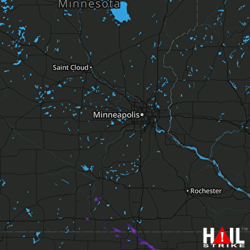 MINNEAPOLIS (KMPX) RADAR

