This weather event on July 21, 2024 includes:
1 states
32 counties,
9 cities,
and 74 zip codes.
There were total properties that were impacted and have possible damage.
States Impacted By Hail On July 21, 2024
Texas
Counties Impacted By Hail On July 21, 2024
Bandera, TX
·
Bexar, TX
·
Blanco, TX
·
Comal, TX
·
Concho, TX
·
Crockett, TX
·
Edwards, TX
·
Gillespie, TX
·
Guadalupe, TX
·
Irion, TX
·
Karnes, TX
·
Kendall, TX
·
Kerr, TX
·
Kimble, TX
·
Kinney, TX
·
Llano, TX
·
Mason, TX
·
Maverick, TX
·
McCulloch, TX
·
Medina, TX
·
Menard, TX
·
Pecos, TX
·
Real, TX
·
San Saba, TX
·
Schleicher, TX
·
Sutton, TX
·
Terrell, TX
·
Tom Green, TX
·
Uvalde, TX
·
Val Verde, TX
·
Webb, TX
·
Zavala, TX
Cities Impacted By Hail On July 21, 2024
Brady, TX
·
Canyon Lake, TX
·
Elm Creek, TX
·
Lackland AFB, TX
·
Mason, TX
·
McQueeney, TX
·
Ozona, TX
·
Seguin, TX
·
Sonora, TX
Zip Codes Impacted By Hail On July 21, 2024
76820
·
76825
·
76831
·
76837
·
76841
·
76842
·
76848
·
76849
·
76854
·
76856
·
76869
·
76874
·
76877
·
76885
·
76904
·
76905
·
76935
·
76936
·
76941
·
76950
·
76955
·
76957
·
78003
·
78006
·
78013
·
78016
·
78027
·
78044
·
78045
·
78070
·
78113
·
78117
·
78123
·
78133
·
78155
·
78214
·
78223
·
78227
·
78236
·
78245
·
78251
·
78252
·
78255
·
78606
·
78618
·
78623
·
78624
·
78631
·
78643
·
78657
·
78663
·
78675
·
78801
·
78828
·
78832
·
78837
·
78840
·
78850
·
78851
·
78852
·
78861
·
78871
·
78880
·
78881
·
78884
·
78885
·
78886
·
79744
·
79781
·
79942
·
76859
·
76943
·
78024
·
78879
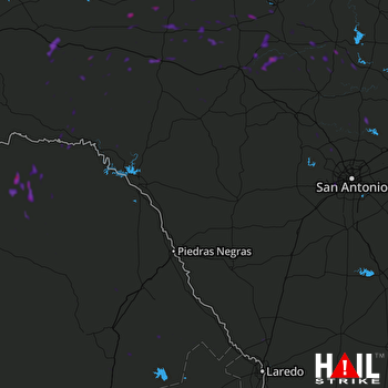 LAUGHLIN AFB (KDFX) RADAR

