This weather event on July 19, 2024 includes:
2 states
25 counties,
25 cities,
and 66 zip codes.
There were 157 total properties that were impacted and have possible damage.
States Impacted By Hail On July 19, 2024
Kansas
·
Nebraska
Counties Impacted By Hail On July 19, 2024
Smith, KS
·
Adams, NE
·
Boone, NE
·
Buffalo, NE
·
Burt, NE
·
Butler, NE
·
Clay, NE
·
Dodge, NE
·
Douglas, NE
·
Franklin, NE
·
Garfield, NE
·
Greeley, NE
·
Hall, NE
·
Hamilton, NE
·
Howard, NE
·
Kearney, NE
·
Merrick, NE
·
Nance, NE
·
Sarpy, NE
·
Saunders, NE
·
Seward, NE
·
Sherman, NE
·
Valley, NE
·
Washington, NE
·
Webster, NE
Cities Impacted By Hail On July 19, 2024
Bladen, NE
·
Blue Hill, NE
·
Cedar Rapids, NE
·
Chapman, NE
·
Cushing, NE
·
Elyria, NE
·
Fremont, NE
·
Giltner, NE
·
Grand Island, NE
·
Greeley Center, NE
·
Gretna, NE
·
Harvard, NE
·
Kenesaw, NE
·
Ord, NE
·
Phillips, NE
·
Prosser, NE
·
Red Cloud, NE
·
Rockville, NE
·
Saronville, NE
·
Scotia, NE
·
Stockham, NE
·
St. Paul, NE
·
Sutton, NE
·
Tamora, NE
·
Utica, NE
Zip Codes Impacted By Hail On July 19, 2024
66952
·
68002
·
68008
·
68017
·
68025
·
68028
·
68029
·
68031
·
68034
·
68059
·
68061
·
68064
·
68313
·
68405
·
68423
·
68434
·
68456
·
68623
·
68626
·
68627
·
68632
·
68665
·
68801
·
68815
·
68818
·
68823
·
68828
·
68835
·
68837
·
68840
·
68841
·
68842
·
68847
·
68852
·
68853
·
68859
·
68862
·
68864
·
68865
·
68866
·
68869
·
68871
·
68872
·
68873
·
68875
·
68876
·
68882
·
68883
·
68925
·
68928
·
68930
·
68932
·
68944
·
68950
·
68952
·
68955
·
68956
·
68959
·
68970
·
68973
·
68975
·
68979
·
68981
·
68854
·
68827
·
68019
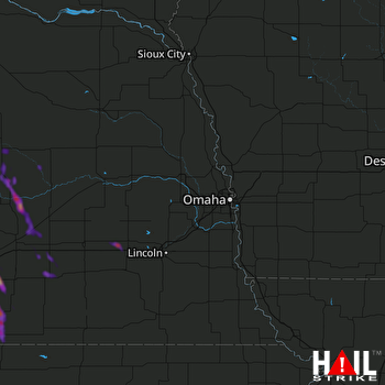 OMAHA (KOAX) RADAR

