This weather event on July 16, 2024 includes:
3 states
32 counties,
11 cities,
and 60 zip codes.
There were 576 total properties that were impacted and have possible damage.
States Impacted By Hail On July 16, 2024
Alabama
·
Louisiana
·
Mississippi
Counties Impacted By Hail On July 16, 2024
Choctaw, AL
·
Clarke, AL
·
Hale, AL
·
Marengo, AL
·
Sumter, AL
·
Avoyelles, LA
·
Concordia, LA
·
Livingston, LA
·
St. Helena, LA
·
St. Tammany, LA
·
Washington, LA
·
West Feliciana, LA
·
Amite, MS
·
Copiah, MS
·
Covington, MS
·
Franklin, MS
·
Hancock, MS
·
Jasper, MS
·
Jefferson Davis, MS
·
Jones, MS
·
Lauderdale, MS
·
Lawrence, MS
·
Newton, MS
·
Perry, MS
·
Pike, MS
·
Rankin, MS
·
Scott, MS
·
Simpson, MS
·
Smith, MS
·
Walthall, MS
·
Wayne, MS
·
Wilkinson, MS
Cities Impacted By Hail On July 16, 2024
Bassfield, MS
·
Ellisville, MS
·
Forest, MS
·
Franklinton, LA
·
Georgetown, MS
·
Hillsboro, MS
·
Lake, MS
·
Meridian, MS
·
Newton, MS
·
Polkville, MS
·
Silver Creek, MS
Zip Codes Impacted By Hail On July 16, 2024
35470
·
36727
·
36744
·
36765
·
36784
·
36921
·
39042
·
39044
·
39059
·
39073
·
39074
·
39078
·
39082
·
39083
·
39092
·
39117
·
39140
·
39149
·
39152
·
39167
·
39191
·
39301
·
39330
·
39332
·
39336
·
39338
·
39345
·
39356
·
39364
·
39421
·
39437
·
39443
·
39459
·
39464
·
39474
·
39476
·
39479
·
39638
·
39641
·
39648
·
39652
·
39654
·
39657
·
39663
·
39665
·
39667
·
70435
·
70437
·
70438
·
70441
·
70450
·
70452
·
70461
·
70711
·
70744
·
71355
·
71373
·
70443
·
39653
·
39465
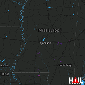 JACKSON (KDGX) RADAR

