This weather event on June 29, 2024 includes:
3 states
24 counties,
21 cities,
and 53 zip codes.
There were 2010 total properties that were impacted and have possible damage.
States Impacted By Hail On June 29, 2024
Kentucky
·
Ohio
·
West Virginia
Counties Impacted By Hail On June 29, 2024
Bath, KY
·
Bourbon, KY
·
Clark, KY
·
Fayette, KY
·
Fleming, KY
·
Greenup, KY
·
Lewis, KY
·
Mason, KY
·
Montgomery, KY
·
Nicholas, KY
·
Rowan, KY
·
Adams, OH
·
Brown, OH
·
Clermont, OH
·
Highland, OH
·
Lawrence, OH
·
Scioto, OH
·
Braxton, WV
·
Calhoun, WV
·
Clay, WV
·
Doddridge, WV
·
Harrison, WV
·
Ritchie, WV
·
Roane, WV
Cities Impacted By Hail On June 29, 2024
Batavia, OH
·
Bentonville, OH
·
Bridgeport, WV
·
Buford, OH
·
Clarksburg, WV
·
Elizaville, KY
·
Ewing, KY
·
Flemingsburg, KY
·
Garrison, KY
·
Lexington-Fayette, KY
·
Maysville, KY
·
Morehead, KY
·
New Boston, OH
·
North Middletown, KY
·
Portsmouth, OH
·
Pullman, WV
·
Rosemount, OH
·
South Shore, KY
·
Vanceburg, KY
·
West Portsmouth, OH
·
Williamsburg, OH
Zip Codes Impacted By Hail On June 29, 2024
45154
·
41175
·
25063
·
25113
·
25141
·
25235
·
25259
·
26301
·
26330
·
26362
·
26404
·
26411
·
26415
·
26421
·
26456
·
40311
·
40313
·
40350
·
40351
·
40353
·
40360
·
40361
·
40374
·
40391
·
40509
·
40516
·
41039
·
41041
·
41049
·
41055
·
41056
·
41141
·
41174
·
41179
·
41189
·
45101
·
45103
·
45133
·
45142
·
45144
·
45171
·
45176
·
45616
·
45650
·
45657
·
45659
·
45662
·
45663
·
45682
·
45684
·
45693
·
45694
·
45697
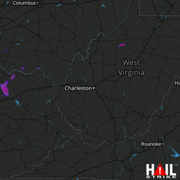 CHARLESTON (KRLX) RADAR

