This weather event on June 18, 2024 includes:
3 states
24 counties,
26 cities,
and 85 zip codes.
There were total properties that were impacted and have possible damage.
States Impacted By Hail On June 18, 2024
Kentucky
·
Ohio
·
West Virginia
Counties Impacted By Hail On June 18, 2024
Estill, KY
·
Fayette, KY
·
Lawrence, KY
·
Madison, KY
·
Martin, KY
·
Scott, KY
·
Coshocton, OH
·
Gallia, OH
·
Holmes, OH
·
Lawrence, OH
·
Meigs, OH
·
Tuscarawas, OH
·
Washington, OH
·
Boone, WV
·
Cabell, WV
·
Kanawha, WV
·
Lincoln, WV
·
Logan, WV
·
Mason, WV
·
Pleasants, WV
·
Putnam, WV
·
Ritchie, WV
·
Roane, WV
·
Wayne, WV
Cities Impacted By Hail On June 18, 2024
Alum Creek, WV
·
Athalia, OH
·
Big Creek, WV
·
Burlington, OH
·
Ceredo, WV
·
Chapmanville, WV
·
Chesapeake, OH
·
Crown City, OH
·
Culloden, WV
·
Dunbar, WV
·
Dundee, OH
·
Fort Gay, WV
·
Georgetown, KY
·
Harts, WV
·
Huntington, WV
·
Hurricane, WV
·
Jefferson, WV
·
Lexington-Fayette, KY
·
Louisa, KY
·
Milton, WV
·
Nitro, WV
·
Salt Rock, WV
·
St. Albans, WV
·
St. Marys, WV
·
Sugarcreek, OH
·
Tornado, WV
Zip Codes Impacted By Hail On June 18, 2024
25053
·
25064
·
25081
·
25106
·
25107
·
25108
·
25112
·
25121
·
25143
·
25154
·
25177
·
25202
·
25203
·
25253
·
25259
·
25265
·
25276
·
25286
·
25309
·
25313
·
25314
·
25505
·
25506
·
25507
·
25508
·
25510
·
25511
·
25512
·
25514
·
25515
·
25517
·
25524
·
25526
·
25534
·
25535
·
25537
·
25540
·
25541
·
25547
·
25555
·
25557
·
25559
·
25565
·
25570
·
25571
·
25674
·
25701
·
25702
·
25703
·
25704
·
25705
·
25003
·
25009
·
25520
·
25669
·
26170
·
41129
·
26337
·
26346
·
40324
·
40336
·
40385
·
40475
·
40515
·
41180
·
41203
·
41224
·
41230
·
41267
·
43824
·
43832
·
43845
·
44622
·
44624
·
44663
·
44680
·
44681
·
45619
·
45623
·
45645
·
45669
·
45678
·
45680
·
45768
·
45771
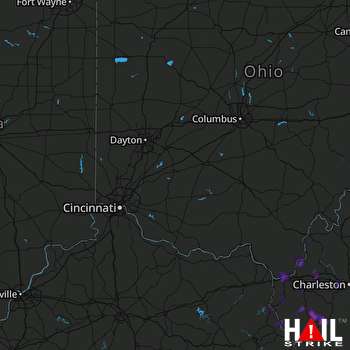 CINCINNATI (KILN) RADAR

