This weather event on May 27, 2024 includes:
1 states
16 counties,
25 cities,
and 45 zip codes.
There were 4617 total properties that were impacted and have possible damage.
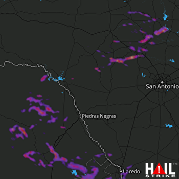 LAUGHLIN AFB (KDFX) RADAR
States Impacted By Hail On May 27, 2024
Texas
Counties Impacted By Hail On May 27, 2024
Bandera, TX
·
Blanco, TX
·
Burnet, TX
·
Edwards, TX
·
Gillespie, TX
·
Kendall, TX
·
Kerr, TX
·
Kimble, TX
·
Kinney, TX
·
Llano, TX
·
Mason, TX
·
McCulloch, TX
·
Real, TX
·
San Saba, TX
·
Val Verde, TX
·
Webb, TX
Cities Impacted By Hail On May 27, 2024
Camp Wood, TX
·
Colorado Acres, TX
·
Comfort, TX
·
El Cenizo, TX
·
Fredericksburg, TX
·
Granite Shoals, TX
·
Harper, TX
·
Highland Haven, TX
·
Horseshoe Bay, TX
·
Kerrville, TX
·
La Presa, TX
·
Laredo, TX
·
Laredo Ranchettes, TX
·
Laredo Ranchettes West, TX
·
Llano, TX
·
Los Altos, TX
·
Ranchitos East, TX
·
Ranchitos Las Lomas, TX
·
Rio Bravo, TX
·
San Carlos I, TX
·
San Carlos II, TX
·
Stonewall, TX
·
Sunrise Beach Village, TX
·
Tanquecitos South Acres, TX
·
Tanquecitos South Acres II, TX
Zip Codes Impacted By Hail On May 27, 2024
76820
·
76825
·
76831
·
76842
·
76849
·
76854
·
76856
·
76869
·
76885
·
76887
·
76950
·
78010
·
78013
·
78019
·
78024
·
78025
·
78028
·
78040
·
78041
·
78043
·
78044
·
78045
·
78046
·
78055
·
78058
·
78618
·
78624
·
78631
·
78636
·
78639
·
78654
·
78657
·
78663
·
78671
·
78675
·
78828
·
78832
·
78837
·
78840
·
78873
·
78880
·
78883
·
78885
·
78833
·
78643

