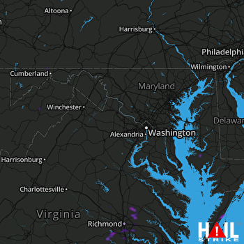
This weather event on May 24, 2024 includes:
4 states
23 counties,
25 cities,
and 65 zip codes.
There were 58 total properties that were impacted and have possible damage.
States Impacted By Hail On May 24, 2024
Maryland
·
Pennsylvania
·
Virginia
·
West Virginia
Counties Impacted By Hail On May 24, 2024
Dorchester, MD
·
Somerset, PA
·
Accomack, VA
·
Amelia, VA
·
Caroline, VA
·
Charles City, VA
·
Chesterfield, VA
·
Goochland, VA
·
Hanover, VA
·
Henrico, VA
·
Hopewell, VA
·
King William, VA
·
Louisa, VA
·
New Kent, VA
·
Northampton, VA
·
Nottoway, VA
·
Petersburg, VA
·
Prince George, VA
·
Richmond, VA
·
Grant, WV
·
Hampshire, WV
·
Hardy, WV
·
Mineral, WV
Cities Impacted By Hail On May 24, 2024
Belle Haven, VA
·
Bellwood, VA
·
Bensley, VA
·
Brandermill, VA
·
Cambridge, MD
·
Cats Bridge, VA
·
Chester, VA
·
East Highland Park, VA
·
Exmore, VA
·
Hanover, VA
·
Highland Springs, VA
·
Hopewell, VA
·
Keller, VA
·
Madison, MD
·
Mappsburg, VA
·
Meadowbrook, VA
·
Mechanicsville, VA
·
Melfa, VA
·
Painter, VA
·
Petersburg, VA
·
Richmond, VA
·
Savage Town, VA
·
Tuckahoe, VA
·
Wellersburg, PA
·
Woodlake, VA
Zip Codes Impacted By Hail On May 24, 2024
15545
·
15552
·
15564
·
21613
·
21648
·
21677
·
23002
·
23005
·
23024
·
23030
·
23047
·
23063
·
23069
·
23075
·
23106
·
23111
·
23112
·
23116
·
23120
·
23141
·
23150
·
23153
·
23192
·
23219
·
23220
·
23222
·
23223
·
23224
·
23225
·
23226
·
23227
·
23229
·
23230
·
23231
·
23234
·
23235
·
23236
·
23237
·
23238
·
23301
·
23306
·
23350
·
23401
·
23410
·
23418
·
23420
·
23423
·
23480
·
23805
·
23824
·
23831
·
23832
·
23834
·
23838
·
23860
·
23875
·
23930
·
26710
·
26719
·
26743
·
26833
·
26852
·
23117
·
23221
·
26845
 STERLING (KLWX) RADAR

