This weather event on May 21, 2024 includes:
4 states
33 counties,
13 cities,
and 71 zip codes.
There were 1398 total properties that were impacted and have possible damage.
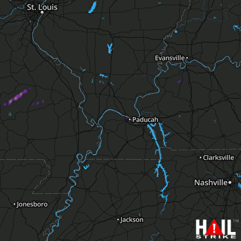 PADUCAH (KPAH) RADAR
States Impacted By Hail On May 21, 2024
Illinois
·
Indiana
·
Kentucky
·
Missouri
Counties Impacted By Hail On May 21, 2024
Gallatin, IL
·
Johnson, IL
·
Massac, IL
·
Saline, IL
·
Union, IL
·
Posey, IN
·
Spencer, IN
·
Warrick, IN
·
Ballard, KY
·
Crittenden, KY
·
Daviess, KY
·
Fulton, KY
·
Henderson, KY
·
Livingston, KY
·
McCracken, KY
·
Union, KY
·
Webster, KY
·
Bollinger, MO
·
Cape Girardeau, MO
·
Crawford, MO
·
Iron, MO
·
Jefferson, MO
·
Madison, MO
·
Mississippi, MO
·
New Madrid, MO
·
Oregon, MO
·
Perry, MO
·
Reynolds, MO
·
Ripley, MO
·
Shannon, MO
·
Stoddard, MO
·
Washington, MO
·
Wayne, MO
Cities Impacted By Hail On May 21, 2024
Anthoston, KY
·
Brookport, IL
·
Ellington, MO
·
Eminence, MO
·
Equality, IL
·
Hatfield, IN
·
Kevil, KY
·
La Center, KY
·
Metropolis, IL
·
Old Shawneetown, IL
·
Paducah, KY
·
Poole, KY
·
Richland, IN
Zip Codes Impacted By Hail On May 21, 2024
63655
·
63621
·
42003
·
42001
·
42028
·
42047
·
42050
·
42053
·
42056
·
42064
·
42078
·
42081
·
42086
·
42301
·
42404
·
42406
·
42409
·
42420
·
42437
·
42451
·
42452
·
42458
·
42462
·
47601
·
47611
·
47620
·
47634
·
47637
·
62905
·
62910
·
62912
·
62934
·
62939
·
62954
·
62960
·
62979
·
62984
·
62998
·
63020
·
63620
·
63626
·
63630
·
63636
·
63638
·
63645
·
63650
·
63654
·
63664
·
63665
·
63674
·
63730
·
63732
·
63743
·
63747
·
63748
·
63755
·
63764
·
63769
·
63771
·
63783
·
63801
·
63823
·
63935
·
63941
·
63956
·
63964
·
65441
·
65466
·
65565
·
65588
·
65606

