This weather event on May 12, 2024 includes:
2 states
31 counties,
13 cities,
and 73 zip codes.
There were 20 total properties that were impacted and have possible damage.
States Impacted By Hail On May 12, 2024
Kansas
·
Nebraska
Counties Impacted By Hail On May 12, 2024
Decatur, KS
·
Ellsworth, KS
·
Gove, KS
·
Graham, KS
·
Jewell, KS
·
Norton, KS
·
Phillips, KS
·
Pottawatomie, KS
·
Rawlins, KS
·
Rooks, KS
·
Sheridan, KS
·
Smith, KS
·
Trego, KS
·
Butler, NE
·
Cass, NE
·
Colfax, NE
·
Dodge, NE
·
Douglas, NE
·
Furnas, NE
·
Gage, NE
·
Harlan, NE
·
Howard, NE
·
Merrick, NE
·
Nuckolls, NE
·
Otoe, NE
·
Pawnee, NE
·
Polk, NE
·
Saunders, NE
·
Sherman, NE
·
Webster, NE
·
York, NE
Cities Impacted By Hail On May 12, 2024
Ashton, NE
·
Burr Oak, KS
·
Glade, KS
·
Grainfield, KS
·
Lenora, KS
·
North Bend, NE
·
Norton, KS
·
Omaha, NE
·
Park, KS
·
Prairie View, KS
·
Selden, KS
·
Shelby, NE
·
Weeping Water, NE
Zip Codes Impacted By Hail On May 12, 2024
66521
·
66932
·
66936
·
66956
·
66967
·
67490
·
67584
·
67622
·
67628
·
67631
·
67639
·
67643
·
67645
·
67646
·
67647
·
67650
·
67653
·
67659
·
67661
·
67664
·
67675
·
67736
·
67737
·
67738
·
67739
·
67740
·
67751
·
67752
·
67753
·
67757
·
68015
·
68018
·
68025
·
68031
·
68066
·
68070
·
68122
·
68134
·
68316
·
68323
·
68346
·
68367
·
68381
·
68417
·
68446
·
68454
·
68458
·
68460
·
68463
·
68467
·
68621
·
68624
·
68632
·
68648
·
68649
·
68658
·
68661
·
68662
·
68666
·
68816
·
68817
·
68820
·
68831
·
68871
·
68872
·
68942
·
68966
·
68977
·
68978
·
68827
·
67749
·
67654
·
67635
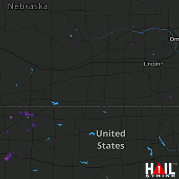 HASTINGS (KUEX) RADAR

