This weather event on May 8, 2024 includes:
3 states
17 counties,
24 cities,
and 69 zip codes.
There were 831 total properties that were impacted and have possible damage.
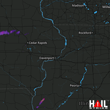 DAVENPORT (KDVN) RADAR
States Impacted By Hail On May 8, 2024
Iowa
·
Illinois
·
Missouri
Counties Impacted By Hail On May 8, 2024
Benton, IA
·
Black Hawk, IA
·
Buchanan, IA
·
Cedar, IA
·
Delaware, IA
·
Grundy, IA
·
Iowa, IA
·
Johnson, IA
·
Linn, IA
·
Marshall, IA
·
Tama, IA
·
Adams, IL
·
Hancock, IL
·
Pike, IL
·
Lewis, MO
·
Marion, MO
·
Ralls, MO
Cities Impacted By Hail On May 8, 2024
Beaman, IA
·
Bowen, IL
·
Brandon, IA
·
Camp Point, IL
·
Cedar Rapids, IA
·
Conrad, IA
·
Coralville, IA
·
Fairfax, IA
·
Hannibal, MO
·
Homestead, IA
·
Lincoln, IA
·
Loraine, IL
·
Mendon, IL
·
Morrison, IA
·
Mount Auburn, IA
·
North Liberty, IA
·
Quincy, IL
·
Reinbeck, IA
·
Tiffin, IA
·
Urbana, IA
·
Vining, IA
·
Vinton, IA
·
Washburn, IA
·
West Point, IL
Zip Codes Impacted By Hail On May 8, 2024
50609
·
50612
·
50621
·
50635
·
50638
·
50643
·
50651
·
50652
·
50654
·
50669
·
50701
·
50702
·
52210
·
52213
·
52215
·
52218
·
52224
·
52228
·
52229
·
52236
·
52240
·
52241
·
52306
·
52313
·
52317
·
52329
·
52337
·
52340
·
52345
·
52346
·
52348
·
52349
·
52352
·
52356
·
52358
·
52404
·
52405
·
52772
·
52776
·
62301
·
62305
·
62312
·
62313
·
62314
·
62316
·
62320
·
62321
·
62324
·
62338
·
62339
·
62343
·
62345
·
62347
·
62349
·
62351
·
62365
·
62367
·
62376
·
62380
·
63401
·
63439
·
63448
·
63461
·
63463
·
63471
·
63456
·
52333
·
52225
·
50675

