This weather event on May 1, 2024 includes:
2 states
27 counties,
21 cities,
and 82 zip codes.
There were 2077 total properties that were impacted and have possible damage.
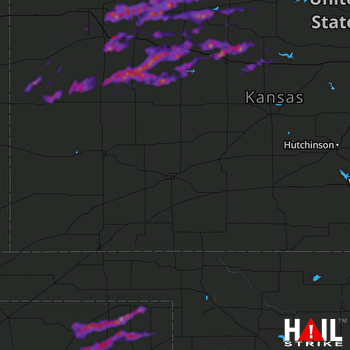 DODGE CITY (KDDC) RADAR
States Impacted By Hail On May 1, 2024
Kansas
·
Texas
Counties Impacted By Hail On May 1, 2024
Barton, KS
·
Decatur, KS
·
Ellis, KS
·
Gove, KS
·
Graham, KS
·
Greeley, KS
·
Lane, KS
·
Logan, KS
·
Ness, KS
·
Norton, KS
·
Osborne, KS
·
Phillips, KS
·
Rawlins, KS
·
Rooks, KS
·
Russell, KS
·
Scott, KS
·
Sheridan, KS
·
Smith, KS
·
Thomas, KS
·
Trego, KS
·
Wallace, KS
·
Wichita, KS
·
Hansford, TX
·
Hutchinson, TX
·
Lipscomb, TX
·
Ochiltree, TX
·
Roberts, TX
Cities Impacted By Hail On May 1, 2024
Bogue, KS
·
Catharine, KS
·
Collyer, KS
·
Damar, KS
·
Darrouzett, TX
·
Ellis, KS
·
Greeley County unified government (balance), KS
·
Grinnell, KS
·
Healy, KS
·
Hill City, KS
·
Hoxie, KS
·
Menlo, KS
·
Morland, KS
·
Oakley, KS
·
Plainville, KS
·
Quinter, KS
·
Russell, KS
·
Spearman, TX
·
Stockton, KS
·
Victoria, KS
·
WaKeeney, KS
Zip Codes Impacted By Hail On May 1, 2024
66951
·
67473
·
67474
·
67515
·
67518
·
67521
·
67544
·
67572
·
67584
·
67622
·
67623
·
67625
·
67626
·
67628
·
67629
·
67631
·
67632
·
67634
·
67635
·
67637
·
67640
·
67642
·
67643
·
67644
·
67645
·
67646
·
67648
·
67649
·
67650
·
67651
·
67654
·
67656
·
67657
·
67658
·
67659
·
67661
·
67663
·
67664
·
67665
·
67669
·
67671
·
67672
·
67673
·
67674
·
67675
·
67730
·
67732
·
67736
·
67737
·
67738
·
67740
·
67743
·
67749
·
67751
·
67752
·
67753
·
67757
·
67758
·
67761
·
67764
·
67839
·
67850
·
67861
·
67863
·
67871
·
67879
·
79005
·
79014
·
79024
·
79033
·
79040
·
79046
·
79056
·
79059
·
79070
·
79080
·
79081
·
79093
·
67846
·
67748
·
67701
·
67601

