This weather event on April 20, 2024 includes:
3 states
29 counties,
25 cities,
and 67 zip codes.
There were 5464 total properties that were impacted and have possible damage.
States Impacted By Hail On April 20, 2024
Alabama
·
Louisiana
·
Mississippi
Counties Impacted By Hail On April 20, 2024
Mobile, AL
·
Washington, AL
·
East Carroll, LA
·
Madison, LA
·
St. Helena, LA
·
Tangipahoa, LA
·
Washington, LA
·
Clarke, MS
·
Covington, MS
·
Forrest, MS
·
Greene, MS
·
Hinds, MS
·
Issaquena, MS
·
Jasper, MS
·
Jones, MS
·
Kemper, MS
·
Lamar, MS
·
Leake, MS
·
Madison, MS
·
Neshoba, MS
·
Newton, MS
·
Pearl River, MS
·
Rankin, MS
·
Scott, MS
·
Sharkey, MS
·
Simpson, MS
·
Smith, MS
·
Wayne, MS
·
Yazoo, MS
Cities Impacted By Hail On April 20, 2024
Bay Springs, MS
·
Brandon, MS
·
Buckatunna, MS
·
Canton, MS
·
Chatom, AL
·
Conehatta, MS
·
Flora, MS
·
Greensburg, LA
·
Heidelberg, MS
·
Hillsboro, MS
·
Jackson, MS
·
Kearney Park, MS
·
Lena, MS
·
Lumberton, MS
·
Madison, MS
·
Mendenhall, MS
·
Morton, MS
·
Mound, LA
·
Mount Vernon, AL
·
Movico, AL
·
Pearl, MS
·
Ridgeland, MS
·
Rolling Fork, MS
·
Roseland, LA
·
State Line, MS
Zip Codes Impacted By Hail On April 20, 2024
36518
·
36521
·
36522
·
36529
·
36539
·
36558
·
36560
·
36583
·
39040
·
39041
·
39042
·
39046
·
39051
·
39054
·
39057
·
39071
·
39074
·
39088
·
39094
·
39111
·
39114
·
39117
·
39145
·
39152
·
39157
·
39159
·
39162
·
39194
·
39208
·
39209
·
39213
·
39322
·
39325
·
39327
·
39328
·
39338
·
39345
·
39350
·
39355
·
39360
·
39362
·
39365
·
39366
·
39367
·
39401
·
39422
·
39437
·
39439
·
39443
·
39455
·
39459
·
39464
·
39476
·
39479
·
39481
·
70422
·
70436
·
70438
·
70441
·
70444
·
70456
·
70465
·
71282
·
71276
·
39577
·
39110
·
38721
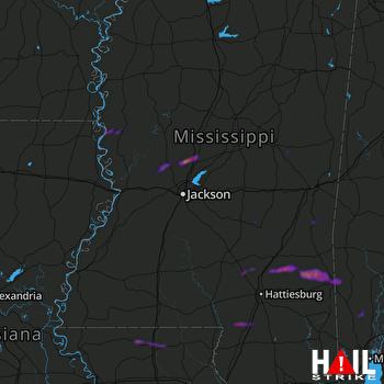 JACKSON (KDGX) RADAR

