This weather event on April 19, 2024 includes:
3 states
31 counties,
24 cities,
and 71 zip codes.
There were total properties that were impacted and have possible damage.
States Impacted By Hail On April 19, 2024
Indiana
·
Kentucky
·
Tennessee
Counties Impacted By Hail On April 19, 2024
Perry, IN
·
Adair, KY
·
Allen, KY
·
Barren, KY
·
Breckinridge, KY
·
Daviess, KY
·
Edmonson, KY
·
Green, KY
·
Hancock, KY
·
Hart, KY
·
Henderson, KY
·
Hopkins, KY
·
Larue, KY
·
McLean, KY
·
Metcalfe, KY
·
Monroe, KY
·
Warren, KY
·
Webster, KY
·
Benton, TN
·
Carroll, TN
·
Decatur, TN
·
Dyer, TN
·
Gibson, TN
·
Henderson, TN
·
Henry, TN
·
Hickman, TN
·
Humphreys, TN
·
Lewis, TN
·
Macon, TN
·
Perry, TN
·
Weakley, TN
Cities Impacted By Hail On April 19, 2024
Atwood, TN
·
Bradford, TN
·
Chesterfield, TN
·
Clarksburg, TN
·
Cloverport, KY
·
Columbia, KY
·
Darden, TN
·
Dixon, KY
·
Dresden, TN
·
Dyer, TN
·
Earlington, KY
·
Greensburg, KY
·
Hardyville, KY
·
Humboldt, TN
·
Lewisport, KY
·
Lexington, TN
·
Milan, TN
·
Poole, KY
·
Rutherford, TN
·
Sharon, TN
·
Slaughters, KY
·
Trenton, TN
·
Trezevant, TN
·
Yorkville, TN
Zip Codes Impacted By Hail On April 19, 2024
37078
·
37083
·
37096
·
37185
·
38059
·
38201
·
38220
·
38225
·
38229
·
38231
·
38233
·
38235
·
38242
·
38255
·
38258
·
38316
·
38317
·
38320
·
38321
·
38328
·
38329
·
38330
·
38342
·
38343
·
38344
·
38348
·
38351
·
38358
·
38363
·
38369
·
38374
·
38382
·
38387
·
38390
·
38462
·
40111
·
40143
·
42127
·
42129
·
42141
·
42154
·
42156
·
42157
·
42164
·
42166
·
42171
·
42210
·
42214
·
42301
·
42327
·
42348
·
42351
·
42413
·
42420
·
42431
·
42452
·
42456
·
42718
·
42728
·
42743
·
42746
·
42748
·
42749
·
42757
·
42765
·
42782
·
47520
·
42409
·
42167
·
38230
·
37033
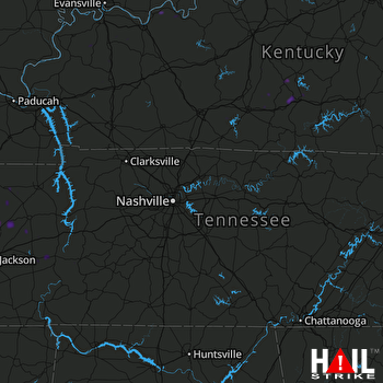 NASHVILLE (KOHX) RADAR

