This weather event on November 2, 2026 includes:
3 states
32 counties,
19 cities,
and 79 zip codes.
There were 149 total properties that were impacted and have possible damage.
States Impacted By Hail On November 2, 2026
Colorado
·
Kansas
·
Oklahoma
Counties Impacted By Hail On November 2, 2026
Prowers, CO
·
Barber, KS
·
Comanche, KS
·
Gove, KS
·
Graham, KS
·
Grant, KS
·
Hamilton, KS
·
Harper, KS
·
Haskell, KS
·
Kiowa, KS
·
Lane, KS
·
Meade, KS
·
Morton, KS
·
Ness, KS
·
Phillips, KS
·
Pratt, KS
·
Rooks, KS
·
Scott, KS
·
Seward, KS
·
Smith, KS
·
Stafford, KS
·
Stanton, KS
·
Stevens, KS
·
Sumner, KS
·
Trego, KS
·
Alfalfa, OK
·
Blaine, OK
·
Custer, OK
·
Dewey, OK
·
Garfield, OK
·
Grant, OK
·
Major, OK
Cities Impacted By Hail On November 2, 2026
Agra, KS
·
Canton, OK
·
Carrier, OK
·
Cleo Springs, OK
·
Cullison, KS
·
Damar, KS
·
Enid, OK
·
Fairview, OK
·
Goltry, OK
·
Helena, OK
·
Kremlin, OK
·
Meno, OK
·
Nash, OK
·
Oakwood, OK
·
Putnam, OK
·
Satanta, KS
·
Ulysses, KS
·
WaKeeney, KS
·
Wakita, OK
Zip Codes Impacted By Hail On November 2, 2026
66951
·
67004
·
67018
·
67022
·
67028
·
67049
·
67066
·
67105
·
67124
·
67152
·
67155
·
67572
·
67576
·
67584
·
67621
·
67625
·
67628
·
67631
·
67632
·
67637
·
67639
·
67642
·
67644
·
67646
·
67656
·
67657
·
67661
·
67663
·
67669
·
67672
·
67675
·
67736
·
67738
·
67752
·
67839
·
67855
·
67857
·
67862
·
67869
·
67870
·
67871
·
67877
·
67878
·
67880
·
67952
·
67953
·
73625
·
73639
·
73654
·
73658
·
73659
·
73663
·
73667
·
73701
·
73703
·
73716
·
73724
·
73727
·
73729
·
73737
·
73739
·
73741
·
73743
·
73747
·
73749
·
73753
·
73755
·
73759
·
73760
·
73761
·
73763
·
73766
·
73768
·
73771
·
73772
·
73835
·
73838
·
81041
·
81084
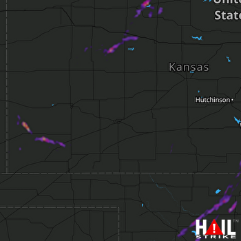 DODGE CITY (KDDC) RADAR