This weather event on October 29, 2026 includes:
4 states
47 counties,
55 cities,
and 170 zip codes.
There were 2736 total properties that were impacted and have possible damage.
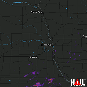 OMAHA (KOAX) RADAR
States Impacted By Hail On October 29, 2026
Iowa
·
Kansas
·
Missouri
·
Nebraska
Counties Impacted By Hail On October 29, 2026
Adair, IA
·
Adams, IA
·
Audubon, IA
·
Cass, IA
·
Clarke, IA
·
Decatur, IA
·
Guthrie, IA
·
Madison, IA
·
Mills, IA
·
Montgomery, IA
·
Page, IA
·
Ringgold, IA
·
Taylor, IA
·
Union, IA
·
Atchison, KS
·
Brown, KS
·
Clay, KS
·
Cloud, KS
·
Doniphan, KS
·
Jackson, KS
·
Jefferson, KS
·
Marshall, KS
·
Nemaha, KS
·
Pottawatomie, KS
·
Republic, KS
·
Washington, KS
·
Andrew, MO
·
Atchison, MO
·
DeKalb, MO
·
Harrison, MO
·
Holt, MO
·
Nodaway, MO
·
Cass, NE
·
Clay, NE
·
Fillmore, NE
·
Gage, NE
·
Jefferson, NE
·
Johnson, NE
·
Lancaster, NE
·
Nuckolls, NE
·
Otoe, NE
·
Pawnee, NE
·
Richardson, NE
·
Saline, NE
·
Saunders, NE
·
Thayer, NE
·
York, NE
Cities Impacted By Hail On October 29, 2026
Atlantic, IA
·
Axtell, KS
·
Barnes, KS
·
Beatrice, NE
·
Bern, KS
·
Big Lake, MO
·
Blanchard, MO
·
Blue Rapids, KS
·
Centralia, KS
·
Clarinda, IA
·
Clifton, KS
·
College Springs, IA
·
Concordia, KS
·
Corning, KS
·
Cumberland, IA
·
Diller, NE
·
Douglas, NE
·
East Peru, IA
·
Fairbury, NE
·
Fortescue, MO
·
Frankfort, KS
·
Glenwood, IA
·
Gravity, IA
·
Harbine, NE
·
Holmesville, NE
·
Jamestown, KS
·
Jansen, NE
·
Kellerton, IA
·
Kickapoo Site 1, KS
·
Kickapoo Site 2, KS
·
Kickapoo Site 6, KS
·
Kickapoo Site 7, KS
·
Kickapoo Tribal Center, KS
·
Lenox, IA
·
Linn, KS
·
Macksburg, IA
·
Marysville, KS
·
Massena, IA
·
Netawaka, KS
·
Oneida, KS
·
Pacific Junction, IA
·
Palmer, KS
·
Pickrell, NE
·
Powhattan, KS
·
Reynolds, NE
·
Seneca, KS
·
Soldier, KS
·
Summerfield, KS
·
Union, NE
·
Valley Falls, KS
·
Vining, KS
·
Waterville, KS
·
Wetmore, KS
·
White Cloud, KS
·
Whiting, KS
Zip Codes Impacted By Hail On October 29, 2026
50002
·
50020
·
50022
·
50058
·
50074
·
50076
·
50108
·
50115
·
50133
·
50140
·
50149
·
50155
·
50174
·
50222
·
50254
·
50274
·
50801
·
50830
·
50833
·
50837
·
50841
·
50843
·
50845
·
50846
·
50848
·
50851
·
50853
·
50857
·
50862
·
50864
·
51534
·
51561
·
51571
·
51573
·
51630
·
51631
·
51632
·
51636
·
51637
·
51646
·
64422
·
64424
·
64430
·
64431
·
64436
·
64437
·
64442
·
64445
·
64451
·
64459
·
64468
·
64470
·
64481
·
64494
·
64498
·
66002
·
66058
·
66088
·
66094
·
66403
·
66404
·
66406
·
66408
·
66411
·
66412
·
66415
·
66416
·
66417
·
66418
·
66419
·
66422
·
66425
·
66427
·
66428
·
66434
·
66436
·
66438
·
66439
·
66502
·
66508
·
66509
·
66515
·
66516
·
66521
·
66522
·
66527
·
66534
·
66538
·
66540
·
66541
·
66544
·
66548
·
66549
·
66550
·
66552
·
66901
·
66930
·
66933
·
66937
·
66938
·
66943
·
66945
·
66946
·
66948
·
66953
·
66958
·
66962
·
66966
·
66968
·
67417
·
67432
·
67447
·
67468
·
68003
·
68017
·
68033
·
68042
·
68048
·
68301
·
68310
·
68318
·
68323
·
68324
·
68328
·
68329
·
68331
·
68332
·
68333
·
68335
·
68337
·
68342
·
68343
·
68344
·
68345
·
68352
·
68355
·
68357
·
68359
·
68361
·
68368
·
68370
·
68372
·
68375
·
68377
·
68381
·
68404
·
68406
·
68409
·
68413
·
68415
·
68416
·
68418
·
68420
·
68422
·
68424
·
68430
·
68431
·
68433
·
68436
·
68443
·
68444
·
68450
·
68455
·
68458
·
68460
·
68464
·
68465
·
68466
·
68467
·
68935