This weather event on October 28, 2026 includes:
4 states
26 counties,
22 cities,
and 84 zip codes.
There were 2457 total properties that were impacted and have possible damage.
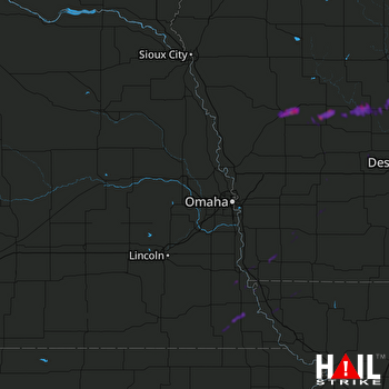 OMAHA (KOAX) RADAR
States Impacted By Hail On October 28, 2026
Iowa
·
Kansas
·
Missouri
·
Nebraska
Counties Impacted By Hail On October 28, 2026
Adams, IA
·
Audubon, IA
·
Boone, IA
·
Carroll, IA
·
Cass, IA
·
Crawford, IA
·
Dallas, IA
·
Fremont, IA
·
Greene, IA
·
Guthrie, IA
·
Mills, IA
·
Montgomery, IA
·
Page, IA
·
Pottawattamie, IA
·
Shelby, IA
·
Webster, IA
·
Clay, KS
·
Cloud, KS
·
Washington, KS
·
Atchison, MO
·
Nodaway, MO
·
Nemaha, NE
·
Otoe, NE
·
Pawnee, NE
·
Richardson, NE
·
Saline, NE
Cities Impacted By Hail On October 28, 2026
Blanchard, IA
·
Blanchard, MO
·
Coburg, IA
·
Dana, IA
·
Denison, IA
·
Fraser, IA
·
Grand Junction, IA
·
Grant, IA
·
Halbur, IA
·
Hamburg, IA
·
Jefferson, IA
·
Manning, IA
·
Panora, IA
·
Perry, IA
·
Pilot Mound, IA
·
Red Oak, IA
·
Scranton, IA
·
Sidney, IA
·
Table Rock, NE
·
Templeton, IA
·
Vail, IA
·
Willey, IA
Zip Codes Impacted By Hail On October 28, 2026
50002
·
50003
·
50022
·
50025
·
50026
·
50036
·
50039
·
50050
·
50058
·
50064
·
50107
·
50115
·
50117
·
50129
·
50167
·
50212
·
50216
·
50217
·
50220
·
50223
·
50250
·
50274
·
50530
·
50543
·
50843
·
50847
·
50857
·
50864
·
51401
·
51430
·
51440
·
51442
·
51443
·
51444
·
51454
·
51455
·
51462
·
51463
·
51465
·
51467
·
51520
·
51532
·
51533
·
51535
·
51536
·
51540
·
51544
·
51551
·
51566
·
51577
·
51601
·
51630
·
51632
·
51638
·
51639
·
51640
·
51645
·
51648
·
51649
·
51650
·
51652
·
51653
·
64428
·
64445
·
64446
·
64482
·
64491
·
64496
·
64498
·
66937
·
66938
·
66962
·
68305
·
68320
·
68321
·
68333
·
68376
·
68378
·
68410
·
68414
·
68421
·
68442
·
68447
·
68448