This weather event on September 21, 2026 includes:
4 states
27 counties,
12 cities,
and 57 zip codes.
There were 229 total properties that were impacted and have possible damage.
States Impacted By Hail On September 21, 2026
Kentucky
·
Ohio
·
Virginia
·
West Virginia
Counties Impacted By Hail On September 21, 2026
Bracken, KY
·
Mason, KY
·
Robertson, KY
·
Adams, OH
·
Athens, OH
·
Brown, OH
·
Clinton, OH
·
Fayette, OH
·
Gallia, OH
·
Greene, OH
·
Highland, OH
·
Hocking, OH
·
Lawrence, OH
·
Meigs, OH
·
Pike, OH
·
Ross, OH
·
Scioto, OH
·
Vinton, OH
·
Buchanan, VA
·
Dickenson, VA
·
Norton, VA
·
Russell, VA
·
Scott, VA
·
Smyth, VA
·
Washington, VA
·
Wise, VA
·
Pocahontas, WV
Cities Impacted By Hail On September 21, 2026
Athens, OH
·
Castlewood, VA
·
Grundy, VA
·
Jeffersonville, OH
·
Marlinton, WV
·
New Marshfield, OH
·
Norton, VA
·
Octa, OH
·
South Webster, OH
·
West Union, OH
·
Wheelersburg, OH
·
Zaleski, OH
Zip Codes Impacted By Hail On September 21, 2026
24202
·
24219
·
24224
·
24230
·
24244
·
24245
·
24256
·
24258
·
24266
·
24270
·
24271
·
24273
·
24283
·
24354
·
24370
·
24607
·
24614
·
24628
·
24954
·
41002
·
41044
·
41064
·
43128
·
43135
·
43138
·
43149
·
43160
·
45115
·
45123
·
45167
·
45168
·
45169
·
45335
·
45601
·
45612
·
45616
·
45650
·
45651
·
45653
·
45654
·
45656
·
45658
·
45659
·
45662
·
45663
·
45672
·
45682
·
45684
·
45688
·
45690
·
45693
·
45694
·
45697
·
45698
·
45701
·
45710
·
45766
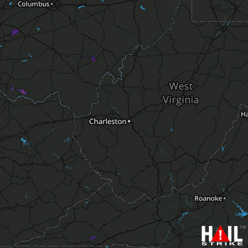 CHARLESTON (KRLX) RADAR

