This weather event on September 17, 2026 includes:
2 states
23 counties,
15 cities,
and 63 zip codes.
There were 89 total properties that were impacted and have possible damage.
States Impacted By Hail On September 17, 2026
Illinois
·
Indiana
Counties Impacted By Hail On September 17, 2026
Iroquois, IL
·
Vermilion, IL
·
Benton, IN
·
Boone, IN
·
Clinton, IN
·
Fountain, IN
·
Fulton, IN
·
Hamilton, IN
·
Hendricks, IN
·
Jasper, IN
·
Kosciusko, IN
·
Marshall, IN
·
Montgomery, IN
·
Newton, IN
·
Noble, IN
·
Parke, IN
·
Starke, IN
·
St. Joseph, IN
·
Tippecanoe, IN
·
Vermillion, IN
·
Warren, IN
·
White, IN
·
Whitley, IN
Cities Impacted By Hail On September 17, 2026
Amo, IN
·
Bourbon, IN
·
Coatesville, IN
·
Covington, IN
·
Danville, IL
·
Etna Green, IN
·
Goodland, IN
·
Kentland, IN
·
Lebanon, IN
·
Linden, IN
·
Perrysville, IN
·
Plainfield, IN
·
Sheldon, IL
·
Sheridan, IN
·
Ulen, IN
Zip Codes Impacted By Hail On September 17, 2026
46035
·
46041
·
46050
·
46052
·
46069
·
46071
·
46103
·
46118
·
46121
·
46168
·
46180
·
46231
·
46504
·
46524
·
46534
·
46550
·
46554
·
46563
·
46614
·
46701
·
46725
·
46787
·
46975
·
47859
·
47909
·
47917
·
47918
·
47922
·
47923
·
47929
·
47930
·
47932
·
47942
·
47944
·
47948
·
47949
·
47951
·
47952
·
47955
·
47967
·
47974
·
47977
·
47980
·
47981
·
47987
·
47989
·
47990
·
47991
·
47992
·
47995
·
60951
·
60966
·
61811
·
61812
·
61817
·
61832
·
61834
·
61841
·
61844
·
61846
·
61858
·
61865
·
61883
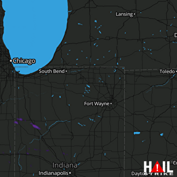 FORT WAYNE (KIWX) RADAR

