This weather event on September 6, 2026 includes:
4 states
22 counties,
13 cities,
and 51 zip codes.
There were total properties that were impacted and have possible damage.
States Impacted By Hail On September 6, 2026
Arkansas
·
Louisiana
·
Mississippi
·
Texas
Counties Impacted By Hail On September 6, 2026
Ashley, AR
·
Columbia, AR
·
Union, AR
·
Bossier, LA
·
Claiborne, LA
·
East Carroll, LA
·
East Feliciana, LA
·
Jackson, LA
·
Lincoln, LA
·
Madison, LA
·
Morehouse, LA
·
Union, LA
·
Webster, LA
·
Winn, LA
·
Warren, MS
·
Wilkinson, MS
·
Hardin, TX
·
Houston, TX
·
Liberty, TX
·
Newton, TX
·
Trinity, TX
·
Tyler, TX
Cities Impacted By Hail On September 6, 2026
Bernice, LA
·
Bonita, LA
·
Cotton Valley, LA
·
Cullen, LA
·
Emerson, AR
·
Felsenthal, AR
·
Homer, LA
·
Huttig, AR
·
Lisbon, LA
·
Magnolia, AR
·
Shongaloo, LA
·
Springhill, LA
·
Warren, TX
Zip Codes Impacted By Hail On September 6, 2026
39183
·
39631
·
39669
·
70761
·
70789
·
71006
·
71018
·
71037
·
71038
·
71040
·
71048
·
71055
·
71071
·
71072
·
71075
·
71079
·
71220
·
71222
·
71223
·
71226
·
71235
·
71250
·
71256
·
71260
·
71261
·
71268
·
71270
·
71276
·
71277
·
71282
·
71286
·
71473
·
71635
·
71730
·
71740
·
71747
·
71749
·
71753
·
71765
·
71860
·
71861
·
75845
·
75847
·
75862
·
77533
·
77538
·
77614
·
77625
·
77632
·
77659
·
77664
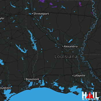 FORT POLK (KPOE) RADAR

