This weather event on September 6, 2026 includes:
2 states
10 counties,
27 cities,
and 47 zip codes.
There were 57 total properties that were impacted and have possible damage.
States Impacted By Hail On September 6, 2026
North Carolina
·
South Carolina
Counties Impacted By Hail On September 6, 2026
Bladen, NC
·
Brunswick, NC
·
Columbus, NC
·
Duplin, NC
·
New Hanover, NC
·
Pender, NC
·
Sampson, NC
·
Dillon, SC
·
Horry, SC
·
Marion, SC
Cities Impacted By Hail On September 6, 2026
Aynor, SC
·
Bald Head Island, NC
·
Burgaw, NC
·
Calabash, NC
·
Carolina Shores, NC
·
Caswell Beach, NC
·
Chadbourn, NC
·
Conway, SC
·
East Arcadia, NC
·
Hallsboro, NC
·
Hampstead, NC
·
Ingold, NC
·
Kelly, NC
·
Kings Grant, NC
·
Lake Waccamaw, NC
·
Murraysville, NC
·
Myrtle Grove, NC
·
Northchase, NC
·
Northwest, NC
·
Riegelwood, NC
·
Rocky Point, NC
·
Sandyfield, NC
·
Silver Lake, NC
·
Sunset Beach, NC
·
Tabor City, NC
·
Watha, NC
·
Wilmington, NC
Zip Codes Impacted By Hail On September 6, 2026
28328
·
28337
·
28403
·
28405
·
28409
·
28411
·
28412
·
28420
·
28421
·
28423
·
28425
·
28429
·
28430
·
28431
·
28432
·
28433
·
28434
·
28435
·
28441
·
28442
·
28443
·
28444
·
28447
·
28448
·
28450
·
28451
·
28453
·
28455
·
28456
·
28457
·
28458
·
28461
·
28463
·
28464
·
28465
·
28466
·
28467
·
28468
·
28472
·
28478
·
28479
·
29511
·
29526
·
29544
·
29545
·
29569
·
29581
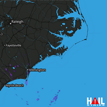 MOREHEAD CITY (KMHX) RADAR

