This weather event on September 5, 2026 includes:
3 states
25 counties,
21 cities,
and 63 zip codes.
There were total properties that were impacted and have possible damage.
States Impacted By Hail On September 5, 2026
Illinois
·
Indiana
·
Missouri
Counties Impacted By Hail On September 5, 2026
Adams, IL
·
Calhoun, IL
·
Edwards, IL
·
Hancock, IL
·
Jefferson, IL
·
Jersey, IL
·
Macoupin, IL
·
Madison, IL
·
Marion, IL
·
Montgomery, IL
·
Wayne, IL
·
Clinton, IN
·
Montgomery, IN
·
Putnam, IN
·
Tippecanoe, IN
·
Audrain, MO
·
Franklin, MO
·
Jefferson, MO
·
Lincoln, MO
·
Montgomery, MO
·
Pike, MO
·
Ralls, MO
·
St. Charles, MO
·
St. Louis, MO
·
Warren, MO
Cities Impacted By Hail On September 5, 2026
Alton, IL
·
Bainbridge, IN
·
Bethalto, IL
·
Colfax, IN
·
Crawfordsville, IN
·
Defiance, MO
·
Godfrey, IL
·
High Ridge, MO
·
Iuka, IL
·
Litchfield, IL
·
Montgomery City, MO
·
Murphy, MO
·
Parkdale, MO
·
Quincy, IL
·
Roachdale, IN
·
Silex, MO
·
Stockwell, IN
·
Truxton, MO
·
Vandalia, MO
·
Wildwood, MO
·
Wilsonville, IL
Zip Codes Impacted By Hail On September 5, 2026
46035
·
46041
·
46105
·
46135
·
46172
·
47905
·
47909
·
47930
·
47933
·
47955
·
47967
·
47981
·
47983
·
47992
·
62002
·
62010
·
62014
·
62018
·
62021
·
62033
·
62035
·
62045
·
62052
·
62053
·
62056
·
62067
·
62070
·
62088
·
62093
·
62097
·
62301
·
62305
·
62316
·
62355
·
62380
·
62806
·
62814
·
62833
·
62837
·
62849
·
62864
·
63005
·
63025
·
63026
·
63038
·
63049
·
63069
·
63073
·
63332
·
63333
·
63339
·
63341
·
63349
·
63351
·
63359
·
63361
·
63363
·
63370
·
63377
·
63379
·
63381
·
63382
·
65041
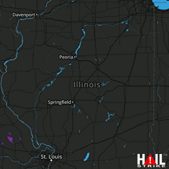 LINCOLN (KILX) RADAR

