This weather event on July 21, 2026 includes:
3 states
18 counties,
18 cities,
and 58 zip codes.
There were total properties that were impacted and have possible damage.
States Impacted By Hail On July 21, 2026
Iowa
·
Missouri
·
Nebraska
Counties Impacted By Hail On July 21, 2026
Fremont, IA
·
Mills, IA
·
Montgomery, IA
·
Page, IA
·
Taylor, IA
·
Andrew, MO
·
Caldwell, MO
·
Daviess, MO
·
DeKalb, MO
·
Gentry, MO
·
Harrison, MO
·
Livingston, MO
·
Nodaway, MO
·
Worth, MO
·
Fillmore, NE
·
Otoe, NE
·
Saline, NE
·
York, NE
Cities Impacted By Hail On July 21, 2026
Allendale, MO
·
Altamont, MO
·
Anderson, IA
·
Coffey, MO
·
Darlington, MO
·
Denver, MO
·
Gallatin, MO
·
Gentry, MO
·
Grant City, MO
·
Imogene, IA
·
Irena, MO
·
Lake Viking, MO
·
McFall, MO
·
Nebraska City, NE
·
New Hampton, MO
·
Shambaugh, IA
·
Shenandoah, IA
·
Worth, MO
Zip Codes Impacted By Hail On July 21, 2026
50833
·
51533
·
51534
·
51540
·
51551
·
51561
·
51601
·
51631
·
51632
·
51636
·
51638
·
51640
·
51645
·
51646
·
51648
·
51649
·
51652
·
51653
·
51654
·
64402
·
64420
·
64423
·
64424
·
64427
·
64428
·
64431
·
64438
·
64441
·
64453
·
64455
·
64456
·
64463
·
64467
·
64468
·
64471
·
64475
·
64479
·
64486
·
64489
·
64499
·
64620
·
64625
·
64636
·
64640
·
64644
·
64647
·
64648
·
64656
·
64657
·
64664
·
64670
·
64689
·
68351
·
68354
·
68359
·
68401
·
68410
·
68467
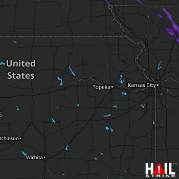 TOPEKA (KTWX) RADAR

