This weather event on July 19, 2026 includes:
4 states
21 counties,
16 cities,
and 49 zip codes.
There were 161 total properties that were impacted and have possible damage.
States Impacted By Hail On July 19, 2026
Georgia
·
North Carolina
·
South Carolina
·
Tennessee
Counties Impacted By Hail On July 19, 2026
Clarke, GA
·
DeKalb, GA
·
Oglethorpe, GA
·
Rockdale, GA
·
White, GA
·
Buncombe, NC
·
Burke, NC
·
Catawba, NC
·
Cleveland, NC
·
Haywood, NC
·
Henderson, NC
·
Jackson, NC
·
McDowell, NC
·
Polk, NC
·
Surry, NC
·
Transylvania, NC
·
Greenville, SC
·
Greenwood, SC
·
McCormick, SC
·
Carter, TN
·
Washington, TN
Cities Impacted By Hail On July 19, 2026
Athens-Clarke County unified government (balance), GA
·
Brevard, NC
·
Central, TN
·
Conover, NC
·
Dana, NC
·
Elizabethton, TN
·
Fairview, NC
·
Hickory, NC
·
Lithonia, GA
·
Mount Airy, NC
·
Mount Carmel, SC
·
Newton, NC
·
Saluda, NC
·
Shelby, NC
·
St. Stephens, NC
·
Yonah, GA
Zip Codes Impacted By Hail On July 19, 2026
27030
·
28150
·
28168
·
28601
·
28602
·
28613
·
28658
·
28708
·
28712
·
28715
·
28716
·
28718
·
28730
·
28731
·
28732
·
28736
·
28739
·
28747
·
28752
·
28761
·
28762
·
28768
·
28773
·
28790
·
28792
·
28801
·
28803
·
28804
·
28805
·
28806
·
29628
·
29635
·
29661
·
29819
·
29840
·
29848
·
30012
·
30038
·
30058
·
30094
·
30528
·
30545
·
30571
·
30605
·
30619
·
30683
·
37601
·
37643
·
37694
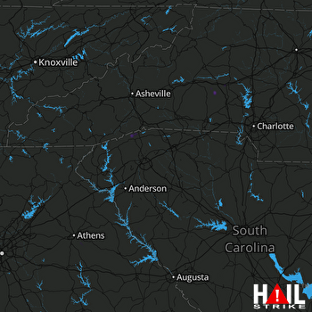 GREER (KGSP) RADAR

