This weather event on July 4, 2026 includes:
5 states
21 counties,
21 cities,
and 56 zip codes.
There were total properties that were impacted and have possible damage.
States Impacted By Hail On July 4, 2026
Georgia
·
North Carolina
·
South Carolina
·
Tennessee
·
Virginia
Counties Impacted By Hail On July 4, 2026
Cherokee, GA
·
Cobb, GA
·
Dawson, GA
·
DeKalb, GA
·
Forsyth, GA
·
Fulton, GA
·
Gwinnett, GA
·
Hall, GA
·
Ashe, NC
·
Yancey, NC
·
Newberry, SC
·
Saluda, SC
·
Union, SC
·
Carter, TN
·
Cocke, TN
·
Greene, TN
·
Johnson, TN
·
Sullivan, TN
·
Washington, TN
·
Russell, VA
·
Washington, VA
Cities Impacted By Hail On July 4, 2026
Abingdon, VA
·
Alpharetta, GA
·
Bristol, TN
·
Buford, GA
·
Dawsonville, GA
·
Doraville, GA
·
Dunwoody, GA
·
Elizabethton, TN
·
Emory, VA
·
Glade Spring, VA
·
Hunter, TN
·
Johns Creek, GA
·
Meadow View, VA
·
Newberry, SC
·
Norcross, GA
·
Peachtree Corners, GA
·
Roswell, GA
·
Sandy Springs, GA
·
Sugar Hill, GA
·
Suwanee, GA
·
Telford, TN
Zip Codes Impacted By Hail On July 4, 2026
24202
·
24210
·
24211
·
24266
·
24270
·
24340
·
24361
·
28615
·
28698
·
28714
·
29031
·
29108
·
29127
·
29138
·
29166
·
29178
·
29379
·
29832
·
30004
·
30005
·
30022
·
30024
·
30028
·
30040
·
30041
·
30067
·
30068
·
30071
·
30076
·
30092
·
30093
·
30097
·
30107
·
30338
·
30339
·
30340
·
30350
·
30360
·
30504
·
30506
·
30518
·
30534
·
30542
·
37601
·
37604
·
37616
·
37618
·
37620
·
37641
·
37643
·
37659
·
37680
·
37683
·
37690
·
37727
·
37743
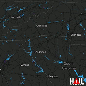 GREER (KGSP) RADAR

