This weather event on June 27, 2026 includes:
4 states
19 counties,
29 cities,
and 56 zip codes.
There were 3879 total properties that were impacted and have possible damage.
States Impacted By Hail On June 27, 2026
Delaware
·
Maryland
·
Virginia
·
West Virginia
Counties Impacted By Hail On June 27, 2026
Kent, DE
·
New Castle, DE
·
Sussex, DE
·
Montgomery, MD
·
Worcester, MD
·
Amelia, VA
·
Chesterfield, VA
·
Dinwiddie, VA
·
Fairfax, VA
·
Hampton, VA
·
Loudoun, VA
·
Newport News, VA
·
Nottoway, VA
·
Poquoson, VA
·
Prince Edward, VA
·
Prince George, VA
·
Sussex, VA
·
York, VA
·
Hampshire, WV
Cities Impacted By Hail On June 27, 2026
Ashburn, VA
·
Bethany Beach, DE
·
Bethel Manor, VA
·
Burkeville, VA
·
Countryside, VA
·
Dagsboro, DE
·
Dranesville, VA
·
Dulles Town Center, VA
·
Fenwick Island, DE
·
Georgetown, DE
·
Great Falls, VA
·
Hampton, VA
·
Herndon, VA
·
Lansdowne, VA
·
Long Neck, DE
·
Millsboro, DE
·
Millville, DE
·
Milton, DE
·
Newport News, VA
·
Oak Grove, VA
·
Ocean City, MD
·
Ocean Pines, MD
·
Ocean View, DE
·
Poquoson, VA
·
Slaughter Beach, DE
·
Smyrna, DE
·
Sterling, VA
·
University Center, VA
·
West Ocean City, MD
Zip Codes Impacted By Hail On June 27, 2026
19938
·
19963
·
26851
·
26823
·
26808
·
23960
·
23954
·
23942
·
23930
·
23922
·
23901
·
23882
·
23867
·
23850
·
23841
·
23838
·
23833
·
23830
·
23824
·
23693
·
23692
·
23666
·
23665
·
23662
·
23606
·
23604
·
23602
·
23601
·
23083
·
23002
·
22066
·
21842
·
21813
·
21811
·
20837
·
20176
·
20170
·
20166
·
20165
·
20164
·
20147
·
19977
·
19975
·
19970
·
19968
·
19967
·
19966
·
19960
·
19956
·
19947
·
19945
·
19944
·
19941
·
19939
·
19930
·
19734
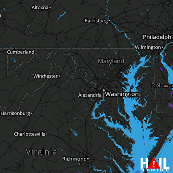 STERLING (KLWX) RADAR

