This weather event on June 26, 2026 includes:
4 states
19 counties,
33 cities,
and 72 zip codes.
There were total properties that were impacted and have possible damage.
States Impacted By Hail On June 26, 2026
Arkansas
·
Kansas
·
Missouri
·
Oklahoma
Counties Impacted By Hail On June 26, 2026
Benton, AR
·
Cherokee, KS
·
Labette, KS
·
Montgomery, KS
·
Jasper, MO
·
McDonald, MO
·
Craig, OK
·
Creek, OK
·
Delaware, OK
·
Lincoln, OK
·
Muskogee, OK
·
Nowata, OK
·
Okfuskee, OK
·
Okmulgee, OK
·
Osage, OK
·
Ottawa, OK
·
Pottawatomie, OK
·
Seminole, OK
·
Washington, OK
Cities Impacted By Hail On June 26, 2026
Afton, OK
·
Altamont, KS
·
Bartlesville, OK
·
Baxter Springs, KS
·
Bella Vista, AR
·
Carl Junction, MO
·
Cayuga, OK
·
Chandler, OK
·
Coffeyville, KS
·
Columbus, KS
·
Copeland, OK
·
Davenport, OK
·
Dearing, KS
·
Fairland, OK
·
Galena, KS
·
Gravette, AR
·
Grove, OK
·
Kenwood, OK
·
Lanagan, MO
·
Leach, OK
·
Lenapah, OK
·
Lowell, KS
·
Meeker, OK
·
Mounds, OK
·
Narcissa, OK
·
Ochelata, OK
·
Quapaw, OK
·
Riverton, KS
·
Scammon, KS
·
Shawnee, OK
·
South Coffeyville, OK
·
Welch, OK
·
White Oak, OK
Zip Codes Impacted By Hail On June 26, 2026
64847
·
74869
·
74868
·
74864
·
74860
·
74855
·
74840
·
74834
·
74804
·
74436
·
74421
·
74369
·
74365
·
74364
·
74363
·
74360
·
74359
·
74354
·
74346
·
74344
·
74343
·
74342
·
74333
·
74331
·
74301
·
74083
·
74079
·
74072
·
74061
·
74056
·
74051
·
74048
·
74047
·
74046
·
74042
·
74028
·
74027
·
74026
·
74022
·
74006
·
74003
·
74002
·
72768
·
72739
·
72736
·
72715
·
72712
·
67364
·
67356
·
67337
·
67333
·
67330
·
67301
·
66781
·
66778
·
66773
·
66770
·
66762
·
66739
·
66728
·
66725
·
66713
·
64870
·
64863
·
64859
·
64855
·
64854
·
64836
·
64834
·
64832
·
64831
·
64748
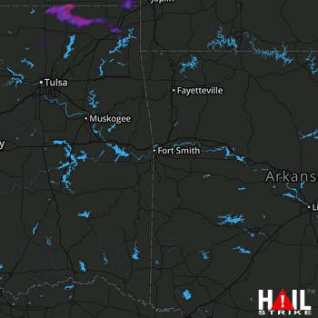 FORT SMITH (KSRX) RADAR

