This weather event on June 26, 2026 includes:
4 states
13 counties,
23 cities,
and 45 zip codes.
There were total properties that were impacted and have possible damage.
States Impacted By Hail On June 26, 2026
Arkansas
·
Illinois
·
Kentucky
·
Missouri
Counties Impacted By Hail On June 26, 2026
Fulton, AR
·
Alexander, IL
·
Pulaski, IL
·
Ballard, KY
·
Marshall, KY
·
Bollinger, MO
·
Cape Girardeau, MO
·
Howell, MO
·
Mississippi, MO
·
Oregon, MO
·
Scott, MO
·
Stoddard, MO
·
Wayne, MO
Cities Impacted By Hail On June 26, 2026
Barlow, KY
·
Benton, MO
·
Bertrand, MO
·
Blodgett, MO
·
Cairo, IL
·
Cape Girardeau, MO
·
Chaffee, MO
·
Charleston, MO
·
Diehlstadt, MO
·
Haywood City, MO
·
Kelso, MO
·
Koshkonong, MO
·
La Center, KY
·
Lambert, MO
·
Miner, MO
·
Morley, MO
·
Mound City, IL
·
Olive Branch, IL
·
Scott City, MO
·
Sikeston, MO
·
Thebes, IL
·
Viola, AR
·
Wickliffe, KY
Zip Codes Impacted By Hail On June 26, 2026
62988
·
63740
·
63787
·
72583
·
72578
·
72576
·
72554
·
72538
·
72531
·
72520
·
65791
·
65775
·
65692
·
63960
·
63846
·
63834
·
63824
·
63823
·
63801
·
63781
·
63780
·
63771
·
63767
·
63766
·
63764
·
63763
·
63758
·
63738
·
63736
·
63735
·
63730
·
63703
·
63701
·
62990
·
62969
·
62964
·
62963
·
62962
·
62957
·
62914
·
42087
·
42056
·
42053
·
42025
·
42024
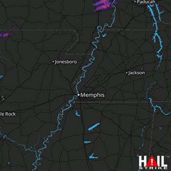 MEMPHIS (KNQA) RADAR

