This weather event on June 24, 2026 includes:
2 states
21 counties,
16 cities,
and 61 zip codes.
There were 1725 total properties that were impacted and have possible damage.
States Impacted By Hail On June 24, 2026
Arkansas
·
Mississippi
Counties Impacted By Hail On June 24, 2026
Crittenden, AR
·
Cross, AR
·
Jackson, AR
·
Lee, AR
·
Phillips, AR
·
Poinsett, AR
·
Sharp, AR
·
St. Francis, AR
·
Woodruff, AR
·
Attala, MS
·
Carroll, MS
·
Coahoma, MS
·
DeSoto, MS
·
Grenada, MS
·
Marshall, MS
·
Montgomery, MS
·
Panola, MS
·
Quitman, MS
·
Tallahatchie, MS
·
Tate, MS
·
Tunica, MS
Cities Impacted By Hail On June 24, 2026
Charleston, MS
·
Coahoma, MS
·
Crowder, MS
·
Darling, MS
·
Friars Point, MS
·
Helena-West Helena, AR
·
Holcomb, MS
·
LaGrange, AR
·
Marianna, AR
·
Marks, MS
·
Palestine, AR
·
Senatobia, MS
·
Tunica Resorts, MS
·
Vaiden, MS
·
Winona, MS
·
Wynne, AR
Zip Codes Impacted By Hail On June 24, 2026
38635
·
72579
·
72521
·
72479
·
72473
·
72469
·
72466
·
72429
·
72396
·
72392
·
72390
·
72374
·
72372
·
72368
·
72366
·
72360
·
72355
·
72348
·
72347
·
72342
·
72340
·
72335
·
72326
·
72112
·
72101
·
72074
·
72005
·
39747
·
39192
·
39176
·
38967
·
38964
·
38963
·
38961
·
38957
·
38947
·
38943
·
38940
·
38927
·
38921
·
38920
·
38917
·
38901
·
38676
·
38670
·
38668
·
38665
·
38664
·
38646
·
38645
·
38643
·
38641
·
38631
·
38626
·
38623
·
38622
·
38621
·
38618
·
38617
·
38614
·
38606
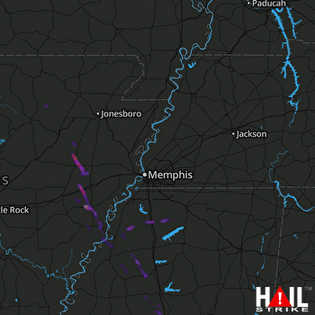 MEMPHIS (KNQA) RADAR

