This weather event on June 17, 2026 includes:
2 states
16 counties,
22 cities,
and 63 zip codes.
There were total properties that were impacted and have possible damage.
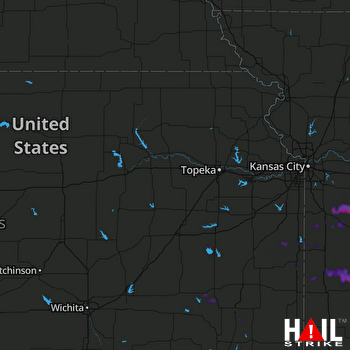 TOPEKA (KTWX) RADAR
States Impacted By Hail On June 17, 2026
Kansas
·
Missouri
Counties Impacted By Hail On June 17, 2026
Allen, KS
·
Anderson, KS
·
Greenwood, KS
·
Linn, KS
·
Miami, KS
·
Neosho, KS
·
Wilson, KS
·
Woodson, KS
·
Bates, MO
·
Cass, MO
·
Cedar, MO
·
Henry, MO
·
Johnson, MO
·
Lafayette, MO
·
St. Clair, MO
·
Vernon, MO
Cities Impacted By Hail On June 17, 2026
Alma, MO
·
Aullville, MO
·
Clinton, MO
·
Concordia, MO
·
Earlton, KS
·
East Lynne, MO
·
Garden City, MO
·
Greeley, KS
·
Gunn City, MO
·
Harrisonville, MO
·
Hartwell, MO
·
Harwood, MO
·
Higginsville, MO
·
Knob Noster, MO
·
La Tour, MO
·
Mayview, MO
·
Rich Hill, MO
·
Rockville, MO
·
Schell City, MO
·
Urich, MO
·
Warrensburg, MO
·
Whiteman AFB, MO
Zip Codes Impacted By Hail On June 17, 2026
66767
·
64726
·
64080
·
66870
·
66852
·
66783
·
66777
·
66776
·
66772
·
66751
·
66748
·
66733
·
66720
·
66717
·
66075
·
66072
·
66056
·
66053
·
66040
·
66033
·
66032
·
66026
·
66014
·
65336
·
65323
·
65321
·
65305
·
64790
·
64788
·
64783
·
64780
·
64779
·
64778
·
64776
·
64761
·
64752
·
64750
·
64747
·
64744
·
64743
·
64742
·
64739
·
64735
·
64733
·
64730
·
64725
·
64724
·
64723
·
64722
·
64720
·
64701
·
64093
·
64078
·
64076
·
64071
·
64067
·
64061
·
64040
·
64037
·
64021
·
64020
·
64019
·
64001

