This weather event on June 13, 2026 includes:
2 states
27 counties,
20 cities,
and 78 zip codes.
There were 143 total properties that were impacted and have possible damage.
States Impacted By Hail On June 13, 2026
Iowa
·
Missouri
Counties Impacted By Hail On June 13, 2026
Appanoose, IA
·
Audubon, IA
·
Clarke, IA
·
Dallas, IA
·
Davis, IA
·
Des Moines, IA
·
Henry, IA
·
Jasper, IA
·
Jefferson, IA
·
Lee, IA
·
Lucas, IA
·
Marion, IA
·
Monroe, IA
·
Polk, IA
·
Ringgold, IA
·
Taylor, IA
·
Union, IA
·
Van Buren, IA
·
Washington, IA
·
Atchison, MO
·
Clark, MO
·
Daviess, MO
·
Gentry, MO
·
Harrison, MO
·
Holt, MO
·
Nodaway, MO
·
Worth, MO
Cities Impacted By Hail On June 13, 2026
Birmingham, IA
·
Blockton, IA
·
Burlington Junction, MO
·
Eagleville, MO
·
Exira, IA
·
Grimes, IA
·
Hopkins, MO
·
Keosauqua, IA
·
Maloy, IA
·
Moravia, IA
·
Mount Ayr, IA
·
Mount Pleasant, IA
·
New London, IA
·
Numa, IA
·
Pickering, MO
·
Quitman, MO
·
Saylorville, IA
·
Skidmore, MO
·
Udell, IA
·
Worth, MO
Zip Codes Impacted By Hail On June 13, 2026
50219
·
52644
·
64428
·
64642
·
64640
·
64632
·
64499
·
64491
·
64487
·
64486
·
64481
·
64479
·
64476
·
64475
·
64470
·
64468
·
64466
·
64461
·
64458
·
64456
·
64455
·
64453
·
64446
·
64442
·
64437
·
64431
·
64426
·
64402
·
63465
·
63445
·
52654
·
52649
·
52645
·
52641
·
52635
·
52626
·
52623
·
52620
·
52594
·
52593
·
52585
·
52580
·
52572
·
52571
·
52570
·
52569
·
52567
·
52565
·
52560
·
52556
·
52544
·
52537
·
52535
·
52531
·
52353
·
50860
·
50854
·
50845
·
50836
·
50835
·
50833
·
50801
·
50313
·
50275
·
50272
·
50264
·
50256
·
50251
·
50238
·
50213
·
50170
·
50150
·
50133
·
50119
·
50111
·
50076
·
50049
·
50023
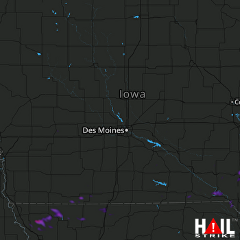 DES MOINES (KDMX) RADAR

