This weather event on June 12, 2026 includes:
4 states
36 counties,
9 cities,
and 91 zip codes.
There were 146 total properties that were impacted and have possible damage.
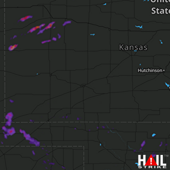 DODGE CITY (KDDC) RADAR
States Impacted By Hail On June 12, 2026
Colorado
·
Kansas
·
Oklahoma
·
Texas
Counties Impacted By Hail On June 12, 2026
Baca, CO
·
Clark, KS
·
Gove, KS
·
Greeley, KS
·
Haskell, KS
·
Kiowa, KS
·
Lane, KS
·
Logan, KS
·
Meade, KS
·
Morton, KS
·
Scott, KS
·
Seward, KS
·
Sheridan, KS
·
Sherman, KS
·
Stanton, KS
·
Stevens, KS
·
Thomas, KS
·
Wallace, KS
·
Alfalfa, OK
·
Beaver, OK
·
Cimarron, OK
·
Custer, OK
·
Dewey, OK
·
Garfield, OK
·
Grant, OK
·
Harper, OK
·
Major, OK
·
Roger Mills, OK
·
Texas, OK
·
Woods, OK
·
Hansford, TX
·
Hemphill, TX
·
Hutchinson, TX
·
Lipscomb, TX
·
Ochiltree, TX
·
Roberts, TX
Cities Impacted By Hail On June 12, 2026
Carmen, OK
·
Elkhart, KS
·
Greeley County unified government (balance), KS
·
Guymon, OK
·
Hardesty, OK
·
Hillsdale, OK
·
Kremlin, OK
·
Meno, OK
·
Spearman, TX
Zip Codes Impacted By Hail On June 12, 2026
73749
·
67840
·
67751
·
67743
·
67109
·
81090
·
81029
·
79093
·
79083
·
79081
·
79070
·
79065
·
79059
·
79040
·
79033
·
79014
·
73950
·
73949
·
73947
·
73945
·
73944
·
73942
·
73939
·
73938
·
73933
·
73932
·
73860
·
73859
·
73855
·
73848
·
73844
·
73842
·
73834
·
73768
·
73766
·
73761
·
73760
·
73754
·
73753
·
73747
·
73743
·
73739
·
73737
·
73729
·
73728
·
73727
·
73726
·
73724
·
73718
·
73717
·
73716
·
73703
·
73701
·
73667
·
73658
·
73654
·
73650
·
73638
·
73628
·
73625
·
67954
·
67953
·
67951
·
67950
·
67901
·
67879
·
67877
·
67871
·
67870
·
67869
·
67864
·
67862
·
67859
·
67855
·
67850
·
67837
·
67834
·
67764
·
67762
·
67761
·
67758
·
67752
·
67748
·
67747
·
67740
·
67738
·
67737
·
67736
·
67735
·
67733
·
67732

