This weather event on June 10, 2026 includes:
4 states
27 counties,
8 cities,
and 73 zip codes.
There were 138 total properties that were impacted and have possible damage.
States Impacted By Hail On June 10, 2026
North Carolina
·
Ohio
·
Pennsylvania
·
West Virginia
Counties Impacted By Hail On June 10, 2026
Alleghany, NC
·
Surry, NC
·
Wilkes, NC
·
Athens, OH
·
Fairfield, OH
·
Guernsey, OH
·
Jackson, OH
·
Knox, OH
·
Meigs, OH
·
Muskingum, OH
·
Perry, OH
·
Vinton, OH
·
Greene, PA
·
Braxton, WV
·
Calhoun, WV
·
Gilmer, WV
·
Jackson, WV
·
Lewis, WV
·
Marshall, WV
·
Mason, WV
·
Pocahontas, WV
·
Randolph, WV
·
Roane, WV
·
Taylor, WV
·
Webster, WV
·
Wirt, WV
·
Wood, WV
Cities Impacted By Hail On June 10, 2026
Albany, OH
·
Burnsville, WV
·
Flat Rock, NC
·
Fultonham, OH
·
Leon, WV
·
Somerset, OH
·
Sutton, WV
·
Wind Ridge, PA
Zip Codes Impacted By Hail On June 10, 2026
26041
·
26203
·
45775
·
45769
·
45741
·
45710
·
45695
·
45692
·
45686
·
43802
·
43783
·
43777
·
43771
·
43767
·
43764
·
43762
·
43760
·
43727
·
43725
·
43720
·
43701
·
43150
·
43130
·
43112
·
43102
·
43028
·
28685
·
28683
·
28675
·
28668
·
27030
·
26631
·
26624
·
26623
·
26619
·
26615
·
26611
·
26610
·
26601
·
26430
·
26412
·
26372
·
26351
·
26347
·
26335
·
26330
·
26298
·
26291
·
26288
·
26282
·
26222
·
26217
·
26206
·
26169
·
26160
·
26151
·
26147
·
26143
·
26141
·
26133
·
26033
·
25276
·
25271
·
25267
·
25244
·
25241
·
25187
·
25123
·
25082
·
24954
·
15380
·
15341
·
15337
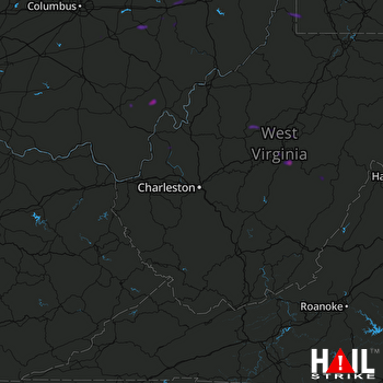 CHARLESTON (KRLX) RADAR

