This weather event on June 9, 2026 includes:
3 states
38 counties,
19 cities,
and 76 zip codes.
There were 71 total properties that were impacted and have possible damage.
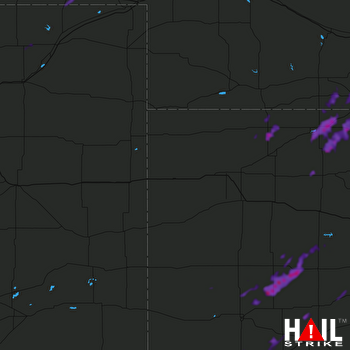 GOODLAND (KGLD) RADAR
States Impacted By Hail On June 9, 2026
Colorado
·
Kansas
·
Nebraska
Counties Impacted By Hail On June 9, 2026
Logan, CO
·
Weld, CO
·
Decatur, KS
·
Ellis, KS
·
Finney, KS
·
Ford, KS
·
Graham, KS
·
Grant, KS
·
Gray, KS
·
Haskell, KS
·
Hodgeman, KS
·
Kearny, KS
·
Lane, KS
·
Meade, KS
·
Morton, KS
·
Ness, KS
·
Norton, KS
·
Pawnee, KS
·
Phillips, KS
·
Rawlins, KS
·
Scott, KS
·
Seward, KS
·
Stanton, KS
·
Stevens, KS
·
Thomas, KS
·
Trego, KS
·
Wichita, KS
·
Arthur, NE
·
Cheyenne, NE
·
Deuel, NE
·
Franklin, NE
·
Furnas, NE
·
Garden, NE
·
Harlan, NE
·
Hitchcock, NE
·
Keith, NE
·
Lincoln, NE
·
Phelps, NE
Cities Impacted By Hail On June 9, 2026
Alma, NE
·
Almena, KS
·
Brownell, KS
·
Cimarron, KS
·
Dodge City, KS
·
Edmond, KS
·
Hanston, KS
·
Holdrege, NE
·
Huntley, NE
·
Lorenzo, NE
·
Naponee, NE
·
Norton, KS
·
Orleans, NE
·
Prairie View, KS
·
Ragan, NE
·
Ransom, KS
·
Republican City, NE
·
Satanta, KS
·
Sidney, NE
Zip Codes Impacted By Hail On June 9, 2026
67749
·
67854
·
80754
·
80751
·
80747
·
80745
·
80742
·
80741
·
80736
·
69163
·
69162
·
69154
·
69149
·
69148
·
69147
·
69146
·
69129
·
69122
·
69121
·
69101
·
69044
·
68982
·
68977
·
68971
·
68969
·
68967
·
68966
·
68960
·
68949
·
68939
·
68926
·
68920
·
67954
·
67952
·
67951
·
67882
·
67880
·
67877
·
67871
·
67870
·
67867
·
67861
·
67860
·
67855
·
67853
·
67849
·
67846
·
67839
·
67837
·
67835
·
67801
·
67744
·
67739
·
67734
·
67701
·
67671
·
67664
·
67661
·
67659
·
67654
·
67653
·
67647
·
67646
·
67645
·
67642
·
67622
·
67601
·
67584
·
67574
·
67572
·
67560
·
67559
·
67523
·
67521
·
67518
·
67515

