This weather event on June 7, 2026 includes:
3 states
26 counties,
24 cities,
and 85 zip codes.
There were 915 total properties that were impacted and have possible damage.
States Impacted By Hail On June 7, 2026
Illinois
·
Indiana
·
Ohio
Counties Impacted By Hail On June 7, 2026
Iroquois, IL
·
Kankakee, IL
·
Livingston, IL
·
Macon, IL
·
Will, IL
·
Benton, IN
·
Boone, IN
·
Carroll, IN
·
Clinton, IN
·
Delaware, IN
·
Hamilton, IN
·
Hancock, IN
·
Henry, IN
·
Jasper, IN
·
Lake, IN
·
Madison, IN
·
Marion, IN
·
Montgomery, IN
·
Newton, IN
·
Pulaski, IN
·
Tippecanoe, IN
·
Tipton, IN
·
White, IN
·
Butler, OH
·
Clinton, OH
·
Highland, OH
Cities Impacted By Hail On June 7, 2026
Anderson, IN
·
Bonfield, IL
·
Bourbonnais, IL
·
Bradley, IL
·
Brook, IN
·
Carmel, IN
·
Cedar Lake, IN
·
Decatur, IL
·
Fishers, IN
·
Frankfort, IN
·
Greenfield, IN
·
Indianapolis city (balance), IN
·
Kankakee, IL
·
Kirklin, IN
·
Lawrence, IN
·
Long Creek, IL
·
Manteno, IL
·
Markleville, IN
·
Monticello, IN
·
Norway, IN
·
Reddick, IL
·
Schneider, IN
·
St. Anne, IL
·
Zionsville, IN
Zip Codes Impacted By Hail On June 7, 2026
46030
·
45011
·
62526
·
62521
·
62501
·
60964
·
60961
·
60954
·
60950
·
60941
·
60940
·
60935
·
60931
·
60924
·
60917
·
60915
·
60914
·
60913
·
60901
·
60481
·
60468
·
60420
·
60401
·
47992
·
47981
·
47978
·
47971
·
47970
·
47967
·
47963
·
47960
·
47959
·
47955
·
47951
·
47946
·
47944
·
47943
·
47942
·
47933
·
47923
·
47922
·
47906
·
47362
·
47356
·
46996
·
46923
·
46920
·
46376
·
46356
·
46310
·
46303
·
46256
·
46250
·
46236
·
46235
·
46220
·
46216
·
46186
·
46147
·
46140
·
46077
·
46074
·
46072
·
46071
·
46070
·
46069
·
46065
·
46062
·
46060
·
46056
·
46055
·
46052
·
46050
·
46041
·
46037
·
46035
·
46032
·
46031
·
46017
·
46016
·
46013
·
46011
·
45177
·
45159
·
45133
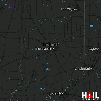 INDIANAPOLIS (KIND) RADAR

