This weather event on June 7, 2026 includes:
3 states
23 counties,
19 cities,
and 53 zip codes.
There were 34 total properties that were impacted and have possible damage.
States Impacted By Hail On June 7, 2026
Illinois
·
Indiana
·
Ohio
Counties Impacted By Hail On June 7, 2026
Grundy, IL
·
Kankakee, IL
·
Livingston, IL
·
Will, IL
·
Boone, IN
·
Carroll, IN
·
Clinton, IN
·
Hamilton, IN
·
Hancock, IN
·
Henry, IN
·
Jasper, IN
·
Lake, IN
·
Madison, IN
·
Marion, IN
·
Montgomery, IN
·
Newton, IN
·
Pulaski, IN
·
Tippecanoe, IN
·
Union, IN
·
Wayne, IN
·
White, IN
·
Butler, OH
·
Preble, OH
Cities Impacted By Hail On June 7, 2026
Bonfield, IL
·
Carbon Hill, IL
·
Channahon, IL
·
Coal City, IL
·
Fishers, IN
·
Frankfort, IN
·
Greenfield, IN
·
Indianapolis city (balance), IN
·
Lawrence, IN
·
Linden, IN
·
Lowell, IN
·
Manteno, IL
·
Middletown, IN
·
Monticello, IN
·
Morris, IL
·
Noblesville, IN
·
Reddick, IL
·
Roselawn, IN
·
West Point, IN
Zip Codes Impacted By Hail On June 7, 2026
47981
·
47933
·
46031
·
60961
·
60950
·
60917
·
60913
·
60901
·
60481
·
60468
·
60450
·
60447
·
60416
·
60410
·
60401
·
47992
·
47978
·
47967
·
47960
·
47959
·
47955
·
47946
·
47943
·
47909
·
47906
·
47374
·
47356
·
47353
·
47010
·
47003
·
46996
·
46920
·
46376
·
46356
·
46310
·
46303
·
46256
·
46250
·
46236
·
46220
·
46216
·
46186
·
46140
·
46071
·
46069
·
46065
·
46060
·
46041
·
46035
·
46030
·
46017
·
45320
·
45056
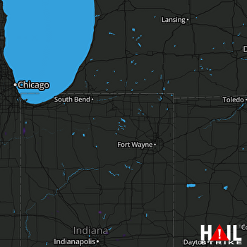 FORT WAYNE (KIWX) RADAR

