This weather event on June 6, 2026 includes:
3 states
12 counties,
20 cities,
and 76 zip codes.
There were 1988 total properties that were impacted and have possible damage.
States Impacted By Hail On June 6, 2026
Maine
·
New Hampshire
·
Vermont
Counties Impacted By Hail On June 6, 2026
Androscoggin, ME
·
Cumberland, ME
·
Oxford, ME
·
York, ME
·
Carroll, NH
·
Cheshire, NH
·
Coos, NH
·
Grafton, NH
·
Addison, VT
·
Orange, VT
·
Rutland, VT
·
Windsor, VT
Cities Impacted By Hail On June 6, 2026
Auburn, ME
·
Brandon, VT
·
Center Sandwich, NH
·
Conway, NH
·
Cousins Island, ME
·
Cumberland Center, ME
·
Fairlee, VT
·
Falmouth, ME
·
Falmouth Foreside, ME
·
Hanover, NH
·
Lebanon, NH
·
Littlejohn Island, ME
·
Naples, ME
·
Norwich, VT
·
Pittsford, VT
·
Portland, ME
·
Saco, ME
·
Westbrook, ME
·
White River Junction, VT
·
Yarmouth, ME
Zip Codes Impacted By Hail On June 6, 2026
5762
·
5751
·
5072
·
3875
·
3768
·
3266
·
5772
·
5767
·
5763
·
5744
·
5738
·
5737
·
5735
·
5733
·
5732
·
5701
·
5084
·
5075
·
5070
·
5068
·
5067
·
5065
·
5059
·
5056
·
5055
·
5053
·
5045
·
5043
·
5032
·
5001
·
4274
·
4260
·
4210
·
4110
·
4105
·
4103
·
4096
·
4093
·
4092
·
4091
·
4087
·
4074
·
4072
·
4071
·
4068
·
4055
·
4047
·
4041
·
4038
·
4032
·
4029
·
4021
·
4015
·
3886
·
3864
·
3860
·
3849
·
3818
·
3784
·
3779
·
3777
·
3755
·
3608
·
3602
·
3592
·
3448
·
3431
·
3285
·
3282
·
3279
·
3262
·
3259
·
3245
·
3227
·
3223
·
3215
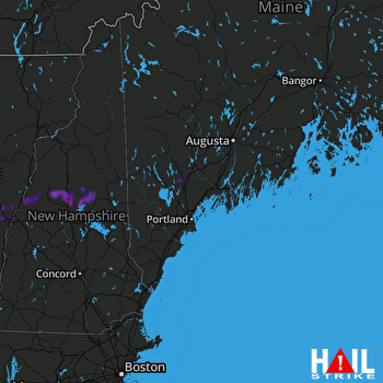 PORTLAND (KGYX) RADAR

