This weather event on June 6, 2026 includes:
4 states
29 counties,
19 cities,
and 89 zip codes.
There were 583 total properties that were impacted and have possible damage.
States Impacted By Hail On June 6, 2026
Iowa
·
Kansas
·
Missouri
·
Nebraska
Counties Impacted By Hail On June 6, 2026
Adair, IA
·
Adams, IA
·
Cass, IA
·
Montgomery, IA
·
Pottawattamie, IA
·
Union, IA
·
Atchison, KS
·
Brown, KS
·
Clay, KS
·
Doniphan, KS
·
Jackson, KS
·
Jefferson, KS
·
Marshall, KS
·
Nemaha, KS
·
Pottawatomie, KS
·
Andrew, MO
·
Atchison, MO
·
Buchanan, MO
·
Daviess, MO
·
DeKalb, MO
·
Gentry, MO
·
Harrison, MO
·
Holt, MO
·
Gage, NE
·
Jefferson, NE
·
Nemaha, NE
·
Pawnee, NE
·
Richardson, NE
·
Thayer, NE
Cities Impacted By Hail On June 6, 2026
Amazonia, MO
·
Amity, MO
·
Brock, NE
·
Carbon, IA
·
Country Club, MO
·
Elliott, IA
·
Fairview, KS
·
Griswold, IA
·
Hiawatha, KS
·
Highland, KS
·
Home, KS
·
Maysville, MO
·
Mound City, MO
·
Neola, IA
·
Phelps City, MO
·
St. Joseph, MO
·
Summerfield, KS
·
Troy, KS
·
Valley Falls, KS
Zip Codes Impacted By Hail On June 6, 2026
64490
·
64632
·
66406
·
68466
·
68457
·
68433
·
68431
·
68420
·
68414
·
68381
·
68370
·
68355
·
68352
·
68345
·
68337
·
68323
·
68321
·
68320
·
67468
·
67432
·
66541
·
66540
·
66538
·
66536
·
66534
·
66532
·
66527
·
66518
·
66509
·
66508
·
66440
·
66438
·
66434
·
66432
·
66425
·
66424
·
66422
·
66418
·
66408
·
66404
·
66403
·
66094
·
66090
·
66088
·
66087
·
66041
·
66035
·
64670
·
64507
·
64506
·
64505
·
64503
·
64501
·
64497
·
64494
·
64485
·
64482
·
64481
·
64473
·
64470
·
64469
·
64466
·
64463
·
64459
·
64451
·
64449
·
64446
·
64443
·
64437
·
64436
·
64430
·
64426
·
64422
·
64421
·
51573
·
51566
·
51560
·
51559
·
51553
·
51535
·
51532
·
51525
·
50864
·
50859
·
50858
·
50857
·
50841
·
50839
·
50801
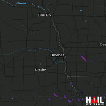 OMAHA (KOAX) RADAR

