This weather event on May 31, 2026 includes:
2 states
26 counties,
29 cities,
and 74 zip codes.
There were 662 total properties that were impacted and have possible damage.
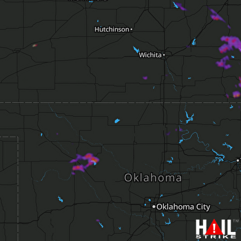 VANCE AFB (KVNX) RADAR
States Impacted By Hail On May 31, 2026
Kansas
·
Oklahoma
Counties Impacted By Hail On May 31, 2026
Butler, KS
·
Chase, KS
·
Chautauqua, KS
·
Clark, KS
·
Dickinson, KS
·
Elk, KS
·
Ford, KS
·
Greenwood, KS
·
Lyon, KS
·
Marion, KS
·
McPherson, KS
·
Montgomery, KS
·
Saline, KS
·
Sumner, KS
·
Wilson, KS
·
Woodson, KS
·
Blaine, OK
·
Caddo, OK
·
Dewey, OK
·
Kay, OK
·
Major, OK
·
Noble, OK
·
Osage, OK
·
Pawnee, OK
·
Washington, OK
·
Woodward, OK
Cities Impacted By Hail On May 31, 2026
Belle Plaine, KS
·
Carlton, KS
·
Chester, OK
·
Climax, KS
·
Conway Springs, KS
·
Eakly, OK
·
El Dorado, KS
·
Elk City, KS
·
Eureka, KS
·
Fredonia, KS
·
Gypsum, KS
·
Hamilton, KS
·
Havana, KS
·
Independence, KS
·
Longdale, OK
·
Madison, KS
·
Marion, KS
·
Neodesha, KS
·
New Albany, KS
·
Niotaze, KS
·
Roxbury, KS
·
Sedan, KS
·
Seiling, OK
·
Severy, KS
·
Spearville, KS
·
Strong City, KS
·
Taloga, OK
·
Toronto, KS
·
Virgil, KS
Zip Codes Impacted By Hail On May 31, 2026
66801
·
66861
·
67063
·
73755
·
74604
·
74653
·
74651
·
74650
·
74644
·
74601
·
74022
·
73859
·
73853
·
73852
·
73838
·
73801
·
73737
·
73724
·
73667
·
73663
·
73659
·
73658
·
73061
·
73048
·
73033
·
73015
·
67876
·
67865
·
67563
·
67483
·
67451
·
67448
·
67438
·
67416
·
67410
·
67363
·
67361
·
67360
·
67355
·
67352
·
67351
·
67349
·
67347
·
67344
·
67337
·
67335
·
67333
·
67301
·
67144
·
67137
·
67122
·
67110
·
67047
·
67045
·
67042
·
67031
·
67013
·
66870
·
66869
·
66865
·
66863
·
66860
·
66858
·
66853
·
66852
·
66850
·
66845
·
66843
·
66838
·
66783
·
66777
·
66757
·
66736
·
66717

