This weather event on May 18, 2026 includes:
2 states
28 counties,
24 cities,
and 82 zip codes.
There were 92 total properties that were impacted and have possible damage.
States Impacted By Hail On May 18, 2026
Indiana
·
Ohio
Counties Impacted By Hail On May 18, 2026
Adams, IN
·
Bartholomew, IN
·
Blackford, IN
·
Brown, IN
·
Delaware, IN
·
Grant, IN
·
Huntington, IN
·
Jay, IN
·
Madison, IN
·
Randolph, IN
·
Wells, IN
·
Allen, OH
·
Auglaize, OH
·
Darke, OH
·
Defiance, OH
·
Fulton, OH
·
Hancock, OH
·
Hardin, OH
·
Henry, OH
·
Logan, OH
·
Mercer, OH
·
Paulding, OH
·
Putnam, OH
·
Seneca, OH
·
Shelby, OH
·
Van Wert, OH
·
Williams, OH
·
Wood, OH
Cities Impacted By Hail On May 18, 2026
Alexandria, IN
·
Ansonia, OH
·
Archbold, OH
·
Bellefontaine, OH
·
Buckland, OH
·
Chickasaw, OH
·
Cloverdale, OH
·
Columbus, IN
·
Continental, OH
·
Edinburgh, IN
·
Findlay, OH
·
Fort Shawnee, OH
·
Fostoria, OH
·
Fowlerton, IN
·
Frankton, IN
·
Lima, OH
·
Melrose, OH
·
Monroe, IN
·
Oakwood, OH
·
Spencerville, OH
·
Summitville, IN
·
Taylorsville, IN
·
Upland, IN
·
Wapakoneta, OH
Zip Codes Impacted By Hail On May 18, 2026
45804
·
45830
·
45865
·
47359
·
47448
·
47394
·
47390
·
47371
·
47369
·
47348
·
47342
·
47326
·
47280
·
47274
·
47235
·
47203
·
47201
·
46989
·
46953
·
46952
·
46938
·
46930
·
46928
·
46792
·
46772
·
46770
·
46766
·
46733
·
46714
·
46164
·
46124
·
46070
·
46044
·
46036
·
46011
·
46001
·
45896
·
45895
·
45887
·
45885
·
45883
·
45879
·
45873
·
45871
·
45869
·
45862
·
45861
·
45860
·
45849
·
45846
·
45844
·
45841
·
45840
·
45831
·
45827
·
45826
·
45822
·
45819
·
45814
·
45806
·
45805
·
45390
·
45380
·
45362
·
45348
·
45331
·
45303
·
45302
·
44830
·
43567
·
43557
·
43549
·
43545
·
43519
·
43512
·
43506
·
43502
·
43331
·
43326
·
43324
·
43311
·
43310
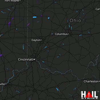 CINCINNATI (KILN) RADAR

