This weather event on May 18, 2026 includes:
2 states
14 counties,
33 cities,
and 65 zip codes.
There were total properties that were impacted and have possible damage.
States Impacted By Hail On May 18, 2026
Indiana
·
Michigan
Counties Impacted By Hail On May 18, 2026
Lake, IN
·
LaPorte, IN
·
Porter, IN
·
Starke, IN
·
St. Joseph, IN
·
Allegan, MI
·
Berrien, MI
·
Cass, MI
·
Kent, MI
·
Manistee, MI
·
Mason, MI
·
Oceana, MI
·
Ottawa, MI
·
Van Buren, MI
Cities Impacted By Hail On May 18, 2026
Allendale, MI
·
Bangor, MI
·
Benton Heights, MI
·
Berrien Springs, MI
·
Breedsville, MI
·
Comstock Park, MI
·
Crown Point, IN
·
Douglas, MI
·
Dowagiac, MI
·
Eastlake, MI
·
Eau Claire, MI
·
Filer City, MI
·
Grandville, MI
·
Hartford, MI
·
Hudson Lake, IN
·
Jenison, MI
·
Lakes of the Four Seasons, IN
·
La Porte, IN
·
Lawrence, MI
·
Manistee, MI
·
Merrillville, IN
·
Niles, MI
·
Oak Hill, MI
·
Parkdale, MI
·
Paw Paw, MI
·
Paw Paw Lake, MI
·
Saugatuck, MI
·
Stevensville, MI
·
Walker, MI
·
Walkerville, MI
·
Watervliet, MI
·
Winfield, IN
·
Zeeland, MI
Zip Codes Impacted By Hail On May 18, 2026
49421
·
49022
·
46360
·
49660
·
49634
·
49626
·
49534
·
49464
·
49459
·
49454
·
49453
·
49450
·
49435
·
49431
·
49428
·
49426
·
49423
·
49420
·
49419
·
49418
·
49411
·
49406
·
49405
·
49401
·
49345
·
49321
·
49129
·
49128
·
49127
·
49126
·
49120
·
49117
·
49113
·
49111
·
49107
·
49106
·
49104
·
49103
·
49102
·
49101
·
49098
·
49090
·
49085
·
49079
·
49064
·
49057
·
49056
·
49047
·
49045
·
49043
·
49038
·
49031
·
49027
·
49013
·
46552
·
46534
·
46532
·
46385
·
46382
·
46371
·
46350
·
46342
·
46341
·
46340
·
46307
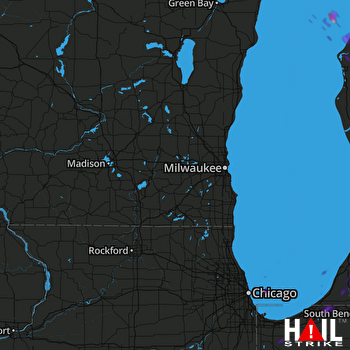 MILWAUKEE (KMKX) RADAR

