This weather event on May 17, 2026 includes:
1 states
15 counties,
26 cities,
and 57 zip codes.
There were 1700 total properties that were impacted and have possible damage.
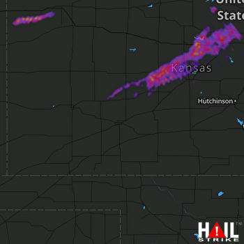 DODGE CITY (KDDC) RADAR
States Impacted By Hail On May 17, 2026
Kansas
Counties Impacted By Hail On May 17, 2026
Barton, KS
·
Ellsworth, KS
·
Finney, KS
·
Hodgeman, KS
·
Lincoln, KS
·
Mitchell, KS
·
Ness, KS
·
Ottawa, KS
·
Pawnee, KS
·
Rice, KS
·
Rush, KS
·
Russell, KS
·
Saline, KS
·
Sherman, KS
·
Thomas, KS
Cities Impacted By Hail On May 17, 2026
Albert, KS
·
Assaria, KS
·
Barnard, KS
·
Beverly, KS
·
Bison, KS
·
Burdett, KS
·
Dorrance, KS
·
Ellsworth, KS
·
Falun, KS
·
Galatia, KS
·
Great Bend, KS
·
Hanston, KS
·
Hoisington, KS
·
Holyrood, KS
·
Kanopolis, KS
·
La Crosse, KS
·
Lincoln Center, KS
·
Odin, KS
·
Olmitz, KS
·
Otis, KS
·
Rush Center, KS
·
Salina, KS
·
Susank, KS
·
Tescott, KS
·
Timken, KS
·
Wilson, KS
Zip Codes Impacted By Hail On May 17, 2026
67481
·
67450
·
67418
·
67854
·
67849
·
67835
·
67743
·
67741
·
67735
·
67733
·
67732
·
67701
·
67665
·
67649
·
67648
·
67634
·
67626
·
67575
·
67574
·
67567
·
67565
·
67564
·
67560
·
67559
·
67556
·
67550
·
67548
·
67544
·
67530
·
67526
·
67525
·
67524
·
67523
·
67520
·
67516
·
67513
·
67511
·
67490
·
67484
·
67467
·
67464
·
67459
·
67456
·
67455
·
67454
·
67452
·
67446
·
67444
·
67442
·
67439
·
67430
·
67427
·
67425
·
67423
·
67420
·
67416
·
67401

